Our latest Motorhome adventure was to spend 4 weeks exploring the
Western Isles following some mouth watering Ground Tour TV programmes from Paul
Murton. After some research we discovered that Caledonian Macbrayne do a
Hopscotch ticket valid for thirty days which allows the traveller to purchase
tickets, at a discount, to visit all the Western Isles that are not connected
by a causeway arriving and departing from either Oban or Stornaway which ever
way round you wish to navigate. The Outer Hebrides or Western Isles consist of
a chain of islands extending 130 miles from the Butt of Lewis in the north to
Barra Head in the south. The principal islands are Lewis and Harris, North and
South Uist, Benbecula and Barra.
 |
| Our first stopover. |
 |
| The Scottish Premier Clubs ground. |
 |
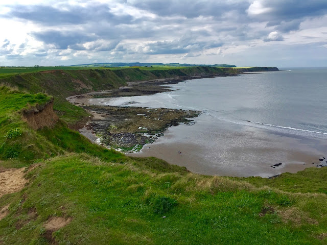
| View across to the Black Isle. |
The first part of what turned out to be a very exciting trip was a 274-mile
journey northward to Inverness and across the Kessock Bridge to the Camping and
Caravan Club Site at Dingwall, which
lies at the head of the Cromarty Firth. Dingwall is a wee market town that boasts
a very nice High Street, with a selection of shops, which of course includes
its fare share of charity establishments, along side some very attractive
private property and buildings. As this was a Sunday the local museum was
closed. The club site is opposite the Stadium of the Scottish Premiership side
Ross County and along side both the River Conon which flows into the Cromarty
Firth and what was the Dingwall Canal which like many other commercial
waterways fell into disrepair after the arrival of the railway. You can still
see some timber structures from the original harbour at the mouth of the canal
and some tie up points for the boats. It now makes a pleasant walk to Jubilee
Park where you will find seating allowing visitors a grand view across to the
Black Isle and out to the Firth. The campsite was again credit to Camping and
Caravan Club and especially to the site managers Ray and Tina. Its well set out
and organised with a warm and very clean facilities block, which as usual some
campers are incapable of appreciating.
 |
| Waiting to load ferry. |
 |
| Some nice comfy seats for the 2.5 hour crossing to Stornaway. |
 |
| Heading out. |
 |
| Arriving at Stornaway Ferry Terminal. |
 Another early start the following morning allowed us to get to Ullapool
well in time to catch the Caledonian Macbrayne Ferry for out next stop over in
Stornaway. A couple of miles north of
the roll-on and roll-off car ferry is the Luxdale
Holiday Park, that has been operating since 1973 and provides facilities
for touring caravans, motor homes, and self catering holiday’s in the form of a
bunkhouse, a luxury lodge and glamping wigwams.
Another early start the following morning allowed us to get to Ullapool
well in time to catch the Caledonian Macbrayne Ferry for out next stop over in
Stornaway. A couple of miles north of
the roll-on and roll-off car ferry is the Luxdale
Holiday Park, that has been operating since 1973 and provides facilities
for touring caravans, motor homes, and self catering holiday’s in the form of a
bunkhouse, a luxury lodge and glamping wigwams.
Stornaway is the main town on the Isle of Lewis with a population of
around 7500 it has a variety of shops including a Co-op and a Tesco with along
with the other shops are closed on Sunday. Visitor attractions include Lews
Castle with its new Museum and its 'Grounds' as they are known locally. Lews Castle
is in the process of having a complete renovation after it fell into disuse in
the early 1990's, work is due to be completed by the end of 2017. The work has
revived the original splendour of the exterior and the internal renovation
looks to be ideal for the future plans to turn it into a first class visitors
attraction, conference centre and function venue. The new Museum, opened by our
First Minister in March, is well worth a visit with 'audio-visual, interactive and object rich
displays' with a cinematic display that provides an introduction to the islands
environment in different seasons. Other exhibits show modern and historic life
on the island. Also displayed are some of the world famous Lewis Chessmen alongside
there known history. For information the walk from the campsite site is a round
trip of three miles although there is a bus services that will take you into
town.

 |
| Lews Castle. |
On our fourth day and on leaving Luxdale we travelled further north to
see various landmarks. The first of which was the Port of Ness or Nis as its
known in Gaelic. All place names; street and road signs on the Hebrides are in both
Gaelic and English. Gaelic is the official language of the islands, is taught
in schools with a great many born and bred locals speaking the language. Port
Ness was at one time a very busy harbour but now is only used once a year when
a party of men depart for Sula Sgeir a small rocky island to harvest young
Gannets. The picturesque harbour and the lovely sandy beach are worth a visit
as is the wee cafe overlooking this wonderful vista.
 |
| Once a year a crew sets sail from the Port of Ness for Sula Sgeir and the harvest. |
 |
| Looking back along the beach to the harbour and the township. |
The next 'port' of call was the sandy dunes and vast beach at the crofting
township of Eoropie and then onto the Butt of Lewis the most northerly point on
the Western Isles which the Guinness Book of Records says is the windiest place
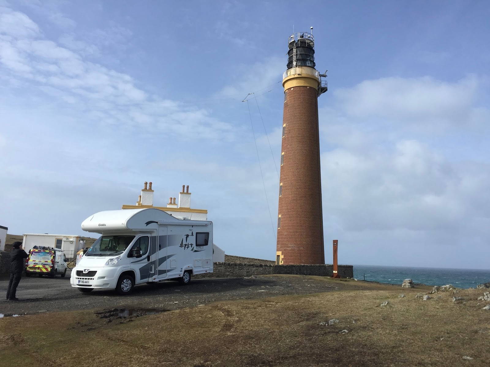
on the coast of the UK recording winds of up to 115 mph. Its 37m high red brick lighthouse was built
by David and Thomas Stevenson, which was first lit in 1862 and became automated
in 1998. This is a wild and rugged landscape and one could spend hours just
watching the sea crash onto the rocky headland, a wonderful spectacle.
 |
| The Stevenson lighthouse. |
 |
| The Butt of Lewis. |
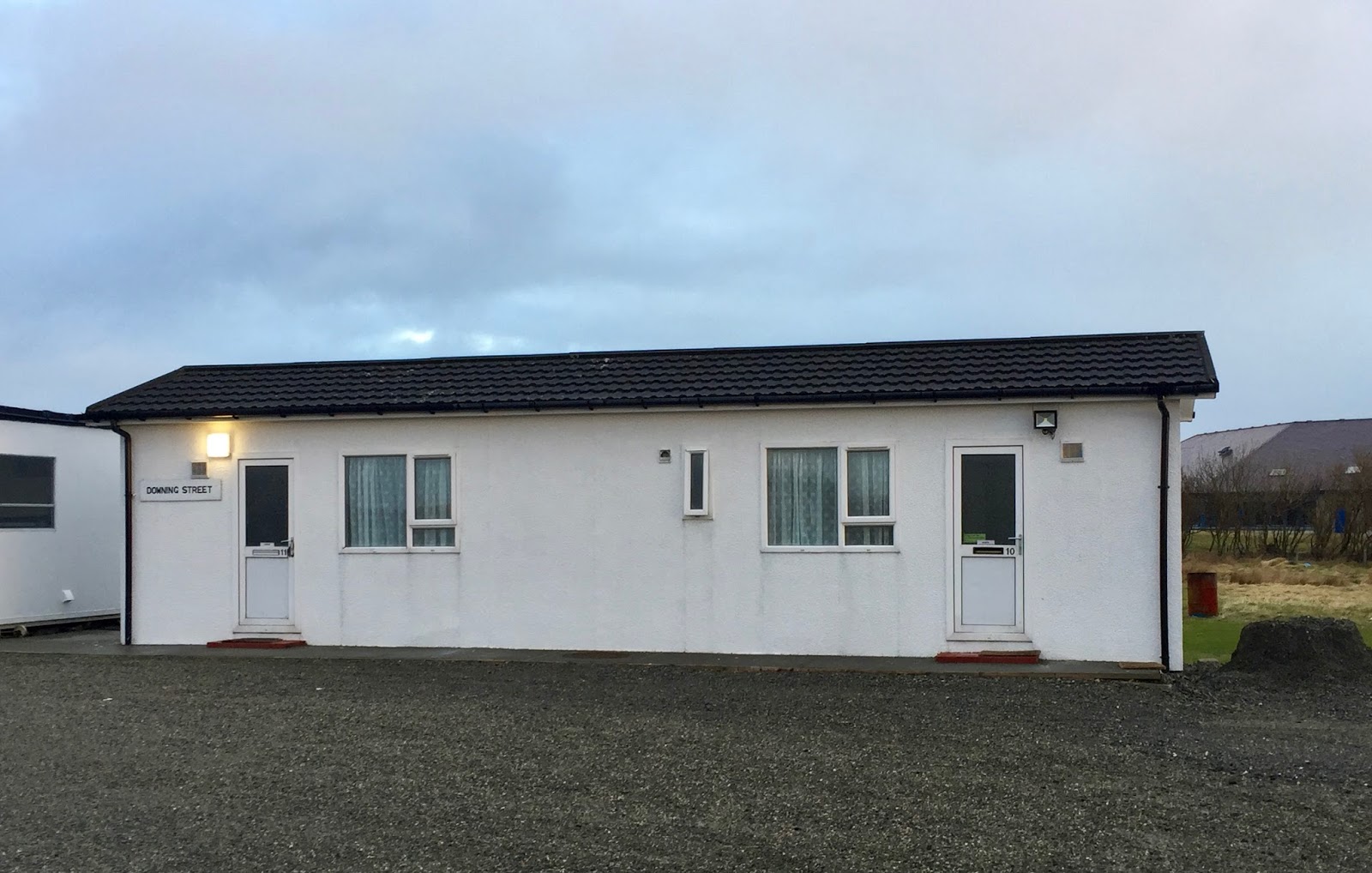
North Shawbost on the northwest coast of Lewis was our next stopover. Eileen Fraoich is a very highly
recommended campsite with 25 hard standing pitches, all with electric. Ours
also had a grey waste drain right next door to the pitch and a Freeview
connection for our TV. The clean and airy facilities block was named ‘Downing
Street’ while the gents had a number '10' on the entrance door and the ladies
had number '11'. It's great to see that some folk still retain a sense of
humour. The only problem with this particular part of the world is that the
wind can be blowing a hoolie so it was decided not to use the bikes but to go
for a walk instead.
 |
| 10 and 11 Downing Street |
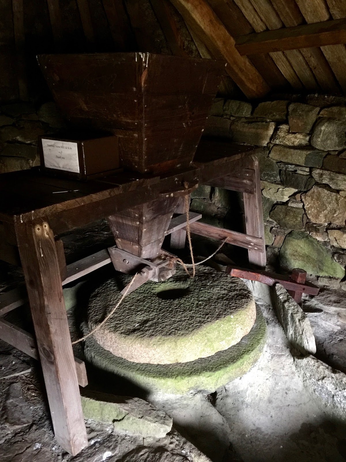
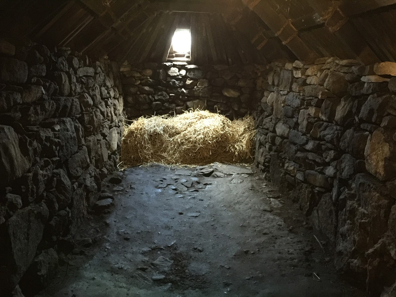
The main purpose was to see the Shawbost Mill a Norse type mill and kiln
but first a walk down past Loch a'Bhaile and on to Shiaboist Cove and its
lovely yellow beach and then up through South Shawbost and right down the main
A858 to the car park and then across country down to the Mill site for a picnic
lunch and a good look around both these beautifully restored buildings. A grand
walk, and the rain kept off although the wind made the walk a wee bit more
tiring than it should have been.
 |
| Mill and Kiln at Shawbost. |
The property on this part of Lewis are very much spread about, even what
you might call wee villages are spread over quite an area, all of which I
believe to be due to the crofting system where land is allocated so that people
can work it. But nothing appears to be grown all you see is sheep grazing,
other than perhaps storage of old cars, farm machinery and other items. It
seems on the surface a strange lonely existence but the people that live here
are very friendly and helpful. It’s not an area that seems to attract the rich,
with none of the normal big newly built out of place houses you see in parts of
Scotland. The newly built property, where it exists fits in with the existing
and always has a very large plot, again to do with the way that land is divided
up into crofts.
 |
| The wide open spaces of North Shawbost on Lewis. |
 |
| No 39 Arnol The Whitehouse. |
 |
| Furnished as it was in 1950. |
 The next part of our Hebrides trip took us to the Island of Harris but
did not involve a ferry as it is joined to Lewis by a narrow neck of land. Our
next campsite was Minch View in South
Harris and the journey there takes you through the village of Tarbert that has
car ferry links to both Uig in Skye and Lochmaddy in North Uist. Tarbert has a
couple of general stores, a hardware shop and a post office as well as Hotel
Hebrides where you can get a good meal or just a cup of coffee which ever takes
your fancy.
The next part of our Hebrides trip took us to the Island of Harris but
did not involve a ferry as it is joined to Lewis by a narrow neck of land. Our
next campsite was Minch View in South
Harris and the journey there takes you through the village of Tarbert that has
car ferry links to both Uig in Skye and Lochmaddy in North Uist. Tarbert has a
couple of general stores, a hardware shop and a post office as well as Hotel
Hebrides where you can get a good meal or just a cup of coffee which ever takes
your fancy.
 |
| The Minch View Camp Site. |
 |
| Looking across The Minch. |
South Harris has two contrasting coast lines, the west coast has a
number of fine sandy beaches while the east side has a very rocky shoreline
with various bays each of which has a small township at its head known as 'The
Bays'. A bike ride around this
undulating coast line gives you a chance to appreciate the barren bleakness of
this moonscape of naked gneiss and its many and varied Lochs, sea inlets and
rocky landscape. The narrow twisting east coast route is known as the ‘Golden
Road’, because of the vast amount of money it cost to build in the 1930's.
 |
| The Golden Road. |
 |
| The rugged East Harris landscape. |
 |
| Small fishing settlements off the Golden Road. |
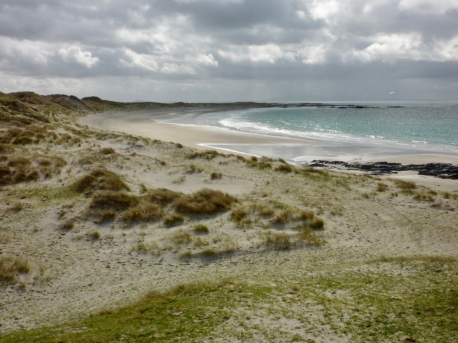
The west side of Harris is a little softer than the east but no less
beautiful and unless you see them for yourselves you never really appreciate
how stunning the beaches are on this side of the island. Even in April the sea
is a bright turquoise colour with fine sand that is a wonderful clean yellow
colour. Your find almost no people, seaweed and certainly no rubbish that would
normally be washed up from passing ships. Follow the A859 from Tarbert and park
at the area above Traigh Lar and walk along the beech, at the far end climb up
to the Clach Mhic Leoid standing stone for a fine view across to the island of
Taransay where the BBC made Castaway 2000 TV series and then head down to
Traigh Nisabost and back up the road or you could drive back to the large car
park which acts as a camp site at certain times during the year. A slow drive
back along the A859 will take you passed Seilebost and its beautiful bay with
its unbelievable vista. One can't help thinking that if the summer weather was
a lot warmer then this would make a lovely family holiday resort, far better
than any you will find in Spain. Our last day on Harris was spent hibernating
in our Motorhome because of the weather. We had 28 hours non-stop heavy rain
and strong winds!
 |
| The west coast of Harris. |
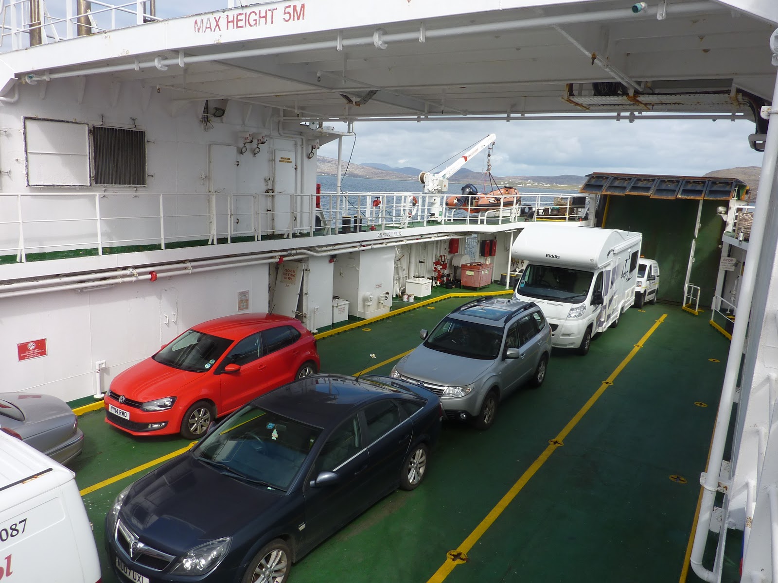
 The following morning the weather had improved and we set off for the
ferry from Leverbough to Berneray. The crossing takes 60 minutes and then
across the causeway to the Isle of North Uist. First impressions are that this
island seems a lot flatter and more fertile than Harris, which is proved by the
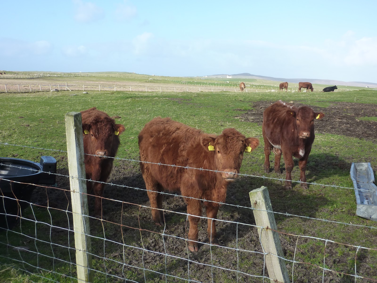
amount of healthy looking beasts on the land - reared for beef and not milk. Balranald Hebridean Holiday Campsite is
a first class site with top class facilities and is located in the heart of the
Balranald Nature Reserve with only a short walk to the beach. The nature
reserve is a magnet for birdwatchers and has a small-unmanned visitors centre
that's open all year. For information the nearest shop for groceries is at
Bayhead 3 miles south of the campsite, although there is a large Co-Op in Solas
that is 8 miles north of the campsite and is on the main road from Leverbough
so supplies can be picked up on your way south.
The following morning the weather had improved and we set off for the
ferry from Leverbough to Berneray. The crossing takes 60 minutes and then
across the causeway to the Isle of North Uist. First impressions are that this
island seems a lot flatter and more fertile than Harris, which is proved by the
amount of healthy looking beasts on the land - reared for beef and not milk. Balranald Hebridean Holiday Campsite is
a first class site with top class facilities and is located in the heart of the
Balranald Nature Reserve with only a short walk to the beach. The nature
reserve is a magnet for birdwatchers and has a small-unmanned visitors centre
that's open all year. For information the nearest shop for groceries is at
Bayhead 3 miles south of the campsite, although there is a large Co-Op in Solas
that is 8 miles north of the campsite and is on the main road from Leverbough
so supplies can be picked up on your way south.
 |
| Leverbough to Berneray Ferry. |
 |
| A healthy fertile landscape. |
 |
| The Black Sheep. |
 |
| The visitors centre. |
If you would like to see a
splendid view of this part of North West Uist then I would suggest the St Kilda
viewpoint from just below the early warning ‘golf ball’ at Cleitreabhal a Deas.
This involves a steady climb of 1.5 miles from the main A865 up a well-made
narrow track road. The views are well worth the climb. Continue further up the
road passed the MOD property to the mast for magnificent views northward along
with grand phone/internet reception.
 |
| The MOD Golf Ball. |
 |
| View from the top. |
The following day the wind was again too
strong for the bikes so it was decided to do the circular waymarked walk from
the visitors centre across the Machair headland. The coastal views are superb
and the birds and sea life are in abundance. The last part of the 4-mile walk
can be taken along the beech and then back via the visitor centre.
 |
| The Machair Headland. |
The greatest characteristic of the Isle of North Uist is its watery
landscape. There would appear to be more water than land mass but that's what
makes this trip so interesting, the different terrain you come across where each
island is different from the last.
 |
| The watery landscape. |
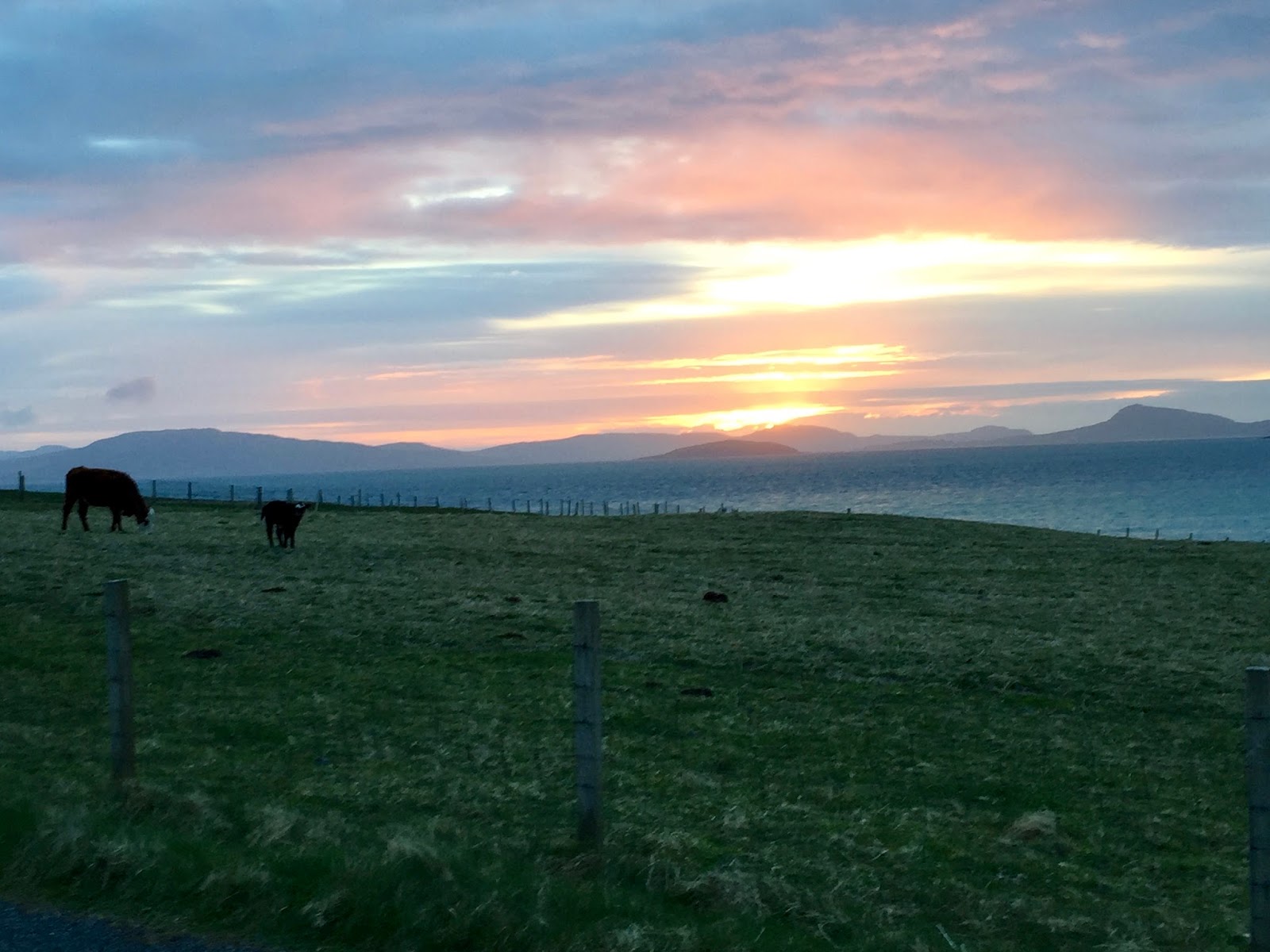
 Our new campsite is situated at Carinish that was once the ferry
terminal to Benbecula that was replaced by the North Ford Causeway in
1960. A short drive south from our camp
site takes you to the Isle of Benbecula and the town of Balivanish where you
will find Maclennans Supermarket, parking is at a wee bit of a premium but the
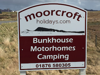
shop itself is very well stocked, has some helpful staff and is very modern. Moorcroft Holiday Campsite and Bunkhouse
is another first class site. Facilities are clean and tidy and again the site
is well laid out. The Bunkhouse has been
converted from an original dwelling house and has two stories and includes all
the facilities needed to spend your holiday in comfort. Also newly installed on
the site are two Hobbit Houses (glamping).
Our new campsite is situated at Carinish that was once the ferry
terminal to Benbecula that was replaced by the North Ford Causeway in
1960. A short drive south from our camp
site takes you to the Isle of Benbecula and the town of Balivanish where you
will find Maclennans Supermarket, parking is at a wee bit of a premium but the
shop itself is very well stocked, has some helpful staff and is very modern. Moorcroft Holiday Campsite and Bunkhouse
is another first class site. Facilities are clean and tidy and again the site
is well laid out. The Bunkhouse has been
converted from an original dwelling house and has two stories and includes all
the facilities needed to spend your holiday in comfort. Also newly installed on
the site are two Hobbit Houses (glamping).
 |
| One of the two Hobbit House's at Moorcroft. |
 |
| Moorcroft Camp Site. |
 |
| View from the site |
Just across the main A865 almost
opposite the entrance to Moorcroft is a circular walk across some heather
covered moorland and around two Lochs nan Cuileag and a Bharpa. Other
interesting things to observe on the walk were the mysterious elongated piles
of stone known as Bharpa Langrass (Heap of Stones) and the peat diggings.
 |
| Bharpa Langrass. |
 |
| Peat workings. |
 |
| The heather covered moorland. |
Its quite surprising how the weather changes from one day to the next,
or perhaps I should say from one hour to the next. Even the weather forecast
can change from when you look at it first thing in the morning and by say ten
o'clock it's changed again. But when the sun does come out it underlines the
beauty of these islands.
 |
| No more funding for projects like this any more! |
On our first full day at Moorcroft we set out on our bikes northerly to
explore. First port of call was Teampall na Trionaid, which translated into
English means Temple of the Trinity. It was a medieval monastery and college of
European significance; founded by Beathag daughter of Somhairle (Somerled) therefore
it was an important seat of learning. It
was enlarged between 1350 and 1390 by Amie Nic Ruari first wife of John 'Lord of the Isles’. Reconstructed in the
16th century and later restored after it was destroyed during the reformation.
The path that takes you up to the Temple has signs to remind you that you are
walking beside the Field of Blood. In 1601 this is where the Battle of Carinish
took place between MacLeod’s of Skye and the MacDonald’s. This fierce battle
killed all but two of the MacLeod’s. After wiping the blood from our boots we preceded
to Balesare, crossing the causeway, built in 1962 to join the island to North
Uist, and on to a clean sandy beach that seems to go on forever. A grand place
to enjoy our picnic lunch before a stroll along the shore.
 |
| Temple of Trinity. |
 |
| Baleshare Beach. |
The following day we woke up to a beautiful sunny morning, out of the
wind it actually felt quite warm so it was decided to cycle south to the Isle of
Benbecula. If North Uist is Protestant, with only one drinking establishment to
its name and South Uist is Catholic, Benbecula, which lies between the two, was
described to us as 'metropolitan' where even the shops open on a Sunday -
decadence at its worst! The Island is steeped in the history of Bonnie Prince
Charlie because its from here that he sailed "over the sea to Skye"
with Flora Macdonald disguised in clothes provided by Lady Clanranald. Our bike
ride took us across a very long causeway built to facilitate the import of supplies
during the upgrading of the WW2 airfield at Balivanish with its links to the
Cold War and continues to be used by the military as well as by civilian
traffic with daily flights to Glasgow, Stornoway and Barra.
 |
| Airport Runway. |
 |
| A typical renovated Benbecula Cottage. |
We continued into Balivanish, passed the airport and then across to
Culla Bay car park were picnic benches were thoughtfully provided to sit and
enjoy our lunch. Again the beach has to be seen to be believed. Further south
from our lunch stop we found the Medieval graveyard and the ruined 14th century
Chapel, Teampall Mhoire, at Nunton and the renovated Nunton Steadings which is
now a Tea Room and Craft Shop which sells lovely home made cakes. A further
mile south down the B892 we took a left for Griminis and across to the War
Memorial and then back north taking the A865 back to Moorcroft. A grand run
that allowed a good look around the Benbecula countryside.
 |
| Culla Bay |
 |
| Nunton Steadings Tea Room. |
 |
| Teampall Mhoire Chapel and graveyard. |
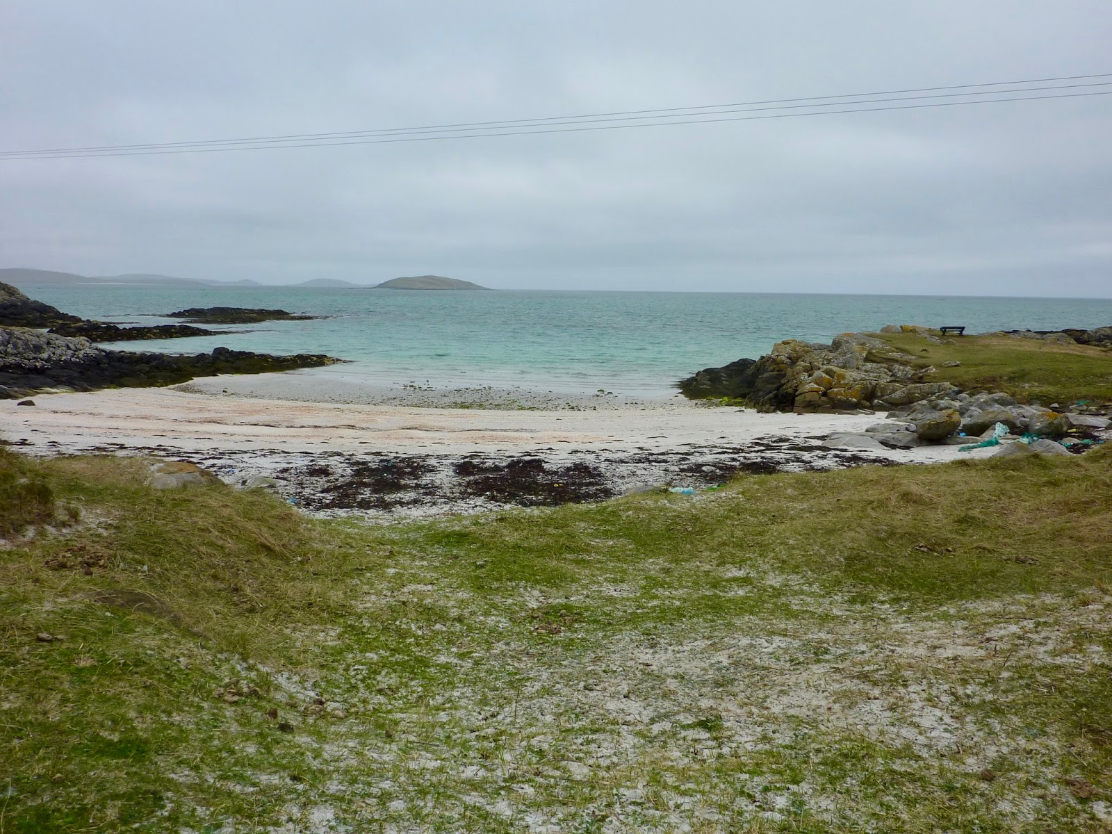
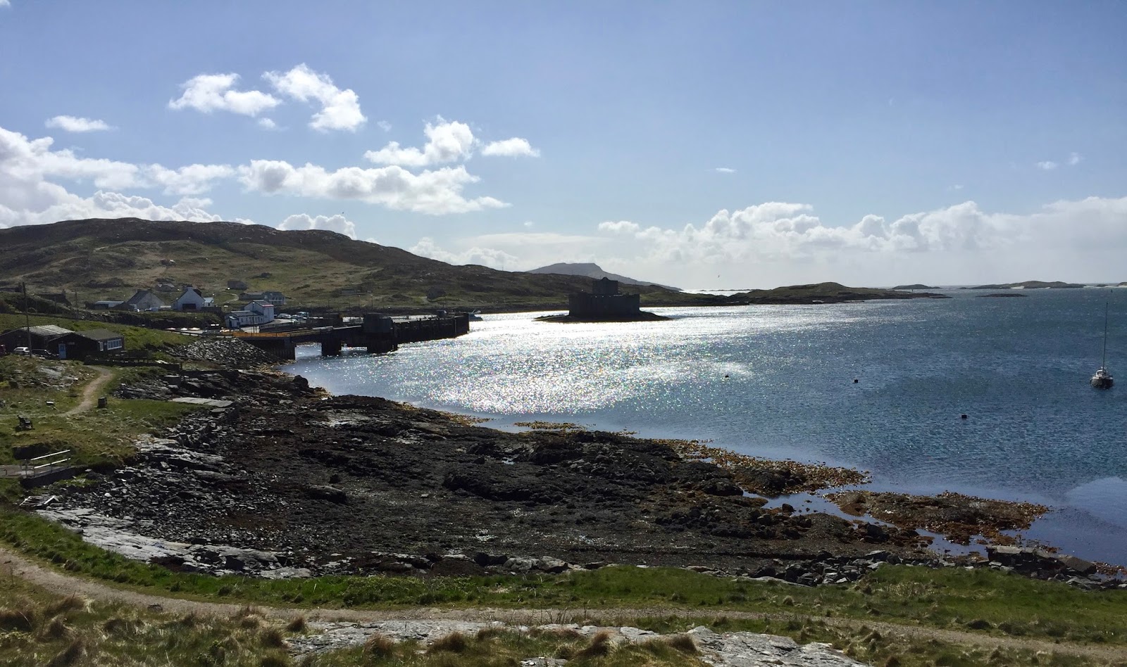
The next stop over, and the last before we take the car ferry to Barra,
was Kilbride Camp Site a small
settlement on the southeast coast of South Uist the second largest island in
the Outer Hebrides. Only the road outside the campsite separates it from the
shore and its sheltered beach that offers views across to Eriskay and Barra.
 |
| The wee beach in front of camp site with Barra seen in the distance. |
 |
| Kilbride Campsite Cafe. |
When you cross over the causeway, which was open in 2001 and cost 9.4
million, from South Uist to Eriskay you again encounter a different landscape,
where as the west side of South Uist is very flat Eriskay is more like a
miniature Highlands and you can easily imagine some of the TV series Outlander
being filmed there. This very picturesque island has various claims to fame.
Firstly you can catch a car ferry to Barra from Ciolleag a' Prionnsa. It was
here on the adjoining beach that Bonnie Prince Charlie first stepped on
Scottish soil. Roaming wild on the island are the Eriskay ponies similar in
stature to their Icelandic cousins and are descended from the native Scottish
ponies and were used to carry peat and seaweed. Also meandering around are some
wonderful black sheep.
 |
| The Causeway to Eriskay. |
 |
| View from South Uist across to Eriskay. |
Probably what is remembered most about the Isle of Eriskay is Compton Mackenzie’s
book Whiskey Galore that was made into a film released by Ealing in 1949 although
most of the location work was shot on the neighbouring island of Barra. The
story is based on a true incident that happened in 1941 when a ship the SS
Politician accidentally hit a submerged rock off the east side of Eriskay. On
board was 21000 cases of malt whisky on there way to America. Fortunately for
the locals the ship was beached in shallow water and the Customs men were slow
in turning up! A stop at the 'am politician’ for coffee and a picnic at Haun
before we headed back to Kilbride and a walk up into the hills for some more spectacular
views.
 |
| Eriskay Ferry Terminal. |
 |
| The beach where Bonnie Prince Charlie first landed in Scotland. |
 |
| The Eriskay countryside. |
 |
| The main settlement. |
 |
| The Am Politician a very rare public house. |
On another lovely sunny warm day we decided to use the Motorhome, which
allowed us to travel further afield. From the ferry port of Lochboisdale, the
chief settlement of South Uist, you can catch a car ferry to both Castlebay and
Oban but I get the distinct feeling that unless the ferry is unloading its
cargo the wee town must otherwise be as quite as we found it, almost a ghost
town, even the pink roofed coffee shop was closed - a notice on the window
informed us that was due to staff sickness! A very smart new marina that was
opened in 2015 sits opposite the ferry jetty and must have cost an awful lot of
money. It seems to have been built for the mooring of private boats and has all
the facilities associated with this leisure activity. It is planned to extend
the harbour at Lochboisdale in the near future to accommodate a new ferry
terminal and to build a new village
along side a scheme to renovate dozens of derelict homes for low cost housing
and tourist rentals. So things should look up for the area in the near future
if Storas Uibhist ambitious plans materialise.
 |
| The famous pink roofed cafe at Lochboisdale. |
 |
| The new Marina. |
 |
| Lochboisdale from the marina. |
Back on the A865 and travelling north our destination was the Kildonan
Centre a renovated former school that consists of a modern museum that explores
the harsh lives of local crofters and cotters through its collection of
artefacts and some very interesting black and white photographs. Also part of
the centre is a very nice cafe where you can get a decent cup of coffee and a
very acceptable plate of fish and chips, our first since coming onto the
islands so it was very much appreciated. Outside the centre you will find a
replica of a typical wooden boat used in times gone by.
 |
| Kildonan Centre. |
 |
| Reminder of times gone by. |
 |
| Just one of the many exhibits in the museum. |
Heading back down the road to Milton we paid a visit to what is said to
be the birthplace of the great Scottish heroine Flora MacDonald's. A large
cairn has been erected with a plaque and is surrounded by ruined blackhouses
that would have formed a wee settlement. We can now boast that we have visited
both her place of birth and where she died on Skye. When we came out of the
Kildonan Centre we got talking to a local gentlemen who told us, quite proudly,
that he was a descendant of the heroine - small world. Tomorrow morning we
again cross the sea by ferry and on to the last part of our incredible journey,
the Isle of Barra.
 |
| Flora MacDonald's birthplace and the commemorative cairn. |
 We certainly picked the right day for our ferry journey, as there was
very little wind and some lovely warm sunshine that made our 40-minute sailing
a real pleasurable experience. Disembarking at Ardmore and travelling to the
northern most part of Barra you pass the 'beach airport', (more of that later)
some more splendid stretches of sandy beach and some lovely green countryside.
Our base was a campsite at the Scurrival Points called quite simply Croft Nr 2; again you get views to die
for including the tidal island of Orasay. A short walk from the site will allow
you to sample the sea lashed headland as well as the community wind turbine.
This was completed in 2014 and started to generate electricity, which is sold
to the grid with the income going back into community projects, once the
company have met their financial obligations. Barra is a very community
orientated island with many of the services on the island run by the community.
We certainly picked the right day for our ferry journey, as there was
very little wind and some lovely warm sunshine that made our 40-minute sailing
a real pleasurable experience. Disembarking at Ardmore and travelling to the
northern most part of Barra you pass the 'beach airport', (more of that later)
some more splendid stretches of sandy beach and some lovely green countryside.
Our base was a campsite at the Scurrival Points called quite simply Croft Nr 2; again you get views to die
for including the tidal island of Orasay. A short walk from the site will allow
you to sample the sea lashed headland as well as the community wind turbine.
This was completed in 2014 and started to generate electricity, which is sold
to the grid with the income going back into community projects, once the
company have met their financial obligations. Barra is a very community
orientated island with many of the services on the island run by the community.
 |
| On our way to Barra. |
 |
| Barra Ferry Terminal. |
 |
| The wonderfully friendly and homely Croft No 2. |
 |
| Community Wind Turbine. |
 |
| The rocky shoreline at Scurrival Point. |
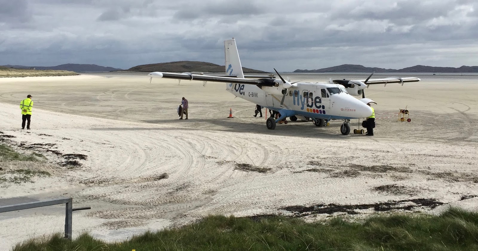
Barra Airport is unique in that it uses a large expanse of beach called
Traigh Mhor as its runways. Obviously fights are dependant on the tide, can't
have the fee-paying passengers getting their feet wet! There are two flights
daily by the Canadian built Twin Otter, and one on Sunday, that will link you
in just over an hour to Glasgow. It’s well worth a visit to the airport to see
the wee plane land and take off, a truly remarkable sight. Also at the airport
is a cafe that has a hot food menu, tea and coffee.
 |
| Barra Airport. |
 |
| Barra Airport has more runways than Heathrow! |
 |
| The Check In. |
 |
| Passengers disembark. |
 |
| Baggage Reclaim. |
Following on from what
turned out to be one of the highlights of our trip we cycled down the west side
of Barra to Borve taking in the wonderful variety of differing scenery
including inland country, rocky seascapes and sandy dunes backed by machair.
 |
| Stones washed up on to the beach from the previous nights rough seas. |
The weather can and does change with very little warning, one moment
bathed in sunshine and the next wind and rain you can't stand up in. But with
gale force winds that rock your Motorhome all night it does not lend it self to
a restful nights sleep. With winds still blowing the following morning cycling
was out of the question so a walk was in order. From the camp site turn right, walk
a short way down the road you will see a sign for the beach. Head across the
field and down on to the Eoligarry beach. This can be followed all the way
along to the pier that was once the terminal of the ferry from Eriskay before re-joining
the road and on to the airport for refreshments.
 |
| Eoligarry Beach |
 |
| The Old Ferry Terminal. |
The return journey along the roadway allowed us to explore Cille Bharpa
(St Barr) Chapel and graveyard. The main part of the 12th century church only
has two walls left standing. To its northeast stands the 16th century
burial-aisle known as the "North Chapel" or "St Mary's
Chapel" which has recently been re-roofed by the Scottish Development
Department. The work has been carried out to house the late medieval carved tombstones,
which had previously lain in the churchyard. Also inside the chapel is the copy
of the runic stone that was also once stood in the churchyard. The original is
now on display at the National Museum of Antiquities in Edinburgh. As well as
generations of Barra residents the author Compton Mackenzie, who lived on Barra
between 1935 and 1945, has also been laid to rest there. The walk back from the
church was enlivened by a horizontal sleet storm that threatened to strip the
skin from your face - thankfully it did not last long.
 |
| Cille Bharpa and St Mary's Chapel. |
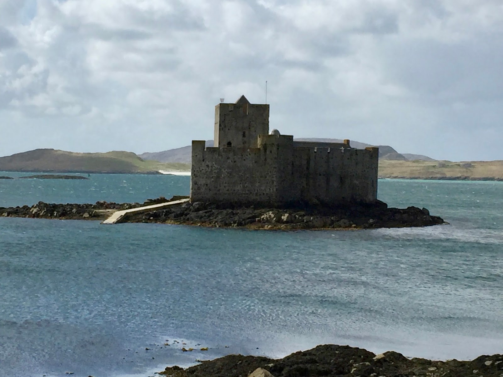
 Driving the Motorhome down to Castlebay offered to prospect of a jolly
good day out, but things don't always turn out as you expect. As we had already
been down the western side on our bikes it was decided to travel down the
eastern side of Barra. Not such a smooth drive with the route being far more windy
and hilly but it does take you through a series of townships including Earsary,
Skallery and Brevig with there fine display of ruined crofting and blackhouses.
Even in April Castlebay does not have a great deal of larger parking spaces for
Motorhome, so I would think that during the summer season it would be best to cycle
or catch a bus in. First off coffee, with the local Post Office providing some
tasty tray bake to go with your caffeine. Next was hopefully a boat trip out to
Kisimul Castle the site of which is said to date back to Norse times although
the existing structure is certainly no earlier than the 15th century. First
disappointment of the day, the boat that takes you to the island was not
running due to the weather, although unusually the sun was shining, health and
safety reasons the friendly lady in the local tourist centre informed us. A
walk through the town showed us some of the local facility's including the
Community School, the sports centre, a well-stocked library, the Heritage Centre
and the Hebridean Toffee shop, which sells some great homemade tablet. If you
return via the footpath back along the shore you will get a history of the
local Herring Boom of the late 19th and early 20th century which involved some
400 boats and over 2000 people employed for the on-shore work. It was the
success of this industry that is said to have made the town what it was today.
Driving the Motorhome down to Castlebay offered to prospect of a jolly
good day out, but things don't always turn out as you expect. As we had already
been down the western side on our bikes it was decided to travel down the
eastern side of Barra. Not such a smooth drive with the route being far more windy
and hilly but it does take you through a series of townships including Earsary,
Skallery and Brevig with there fine display of ruined crofting and blackhouses.
Even in April Castlebay does not have a great deal of larger parking spaces for
Motorhome, so I would think that during the summer season it would be best to cycle
or catch a bus in. First off coffee, with the local Post Office providing some
tasty tray bake to go with your caffeine. Next was hopefully a boat trip out to
Kisimul Castle the site of which is said to date back to Norse times although
the existing structure is certainly no earlier than the 15th century. First
disappointment of the day, the boat that takes you to the island was not
running due to the weather, although unusually the sun was shining, health and
safety reasons the friendly lady in the local tourist centre informed us. A
walk through the town showed us some of the local facility's including the
Community School, the sports centre, a well-stocked library, the Heritage Centre
and the Hebridean Toffee shop, which sells some great homemade tablet. If you
return via the footpath back along the shore you will get a history of the
local Herring Boom of the late 19th and early 20th century which involved some
400 boats and over 2000 people employed for the on-shore work. It was the
success of this industry that is said to have made the town what it was today.
 |
| Castlebay is the largest township on Barra. |
 |
| The summer season could bring problems parking. |
 |
| Kisimul Castle. |
Before we carried on to the island of Vatersay the most southerly-inhabited
island in the Outer Hebrides we stopped at the local Co-Op for supplies. Whist
shopping in the store we were informed that the Co-Ops hurst, fully loaded with
a coffin ready to collect a customer, crashed into our Motorhome causing some
damage to the rear of the drivers side including the lighting panel. Although
admitting liability it's still something you could well do without especially
as we had already lost our driving mirror in a hit and run in Harris. So
needless to say after sorting out the details and a long conversation with our
insurance company we went off the idea of visiting Vatersay and drove back to
our Campsite vowing not to use the Motorhome again until we had to drive back
to Castlebay to catch the early morning car ferry to Oban.
After our previously stressful day it was decided to go back to two
wheels. The airport is becoming a wee magnet because it’s the only place at the
north end of the island where we can purchase a cup of coffee and this morning
was no different. Blue sky and sunshine accompanied us down via Northbay to
Aird Mhidhinis (Ardveenish) to check out the deep-water pier that acts as the
main base of the fishing industry on Barra. Also there is the Barratlantic fish
factory from which Whitefish, prawns and scallops are trucked daily to the
Scottish mainland and the small Barra Power Station is also located there. From
there we continued our journey retracing our steps back to the Ard Mhor
junction and riding down to the where the roro car ferry commute's with
Eriskay. Outside the terminal there is a fine sculpture of two otters chasing a
Salmon.
 |
| Northbay area. |
 |
| The deep water pier. |
 |
| Trucking fish to the mainland. |
 |
| The Otter Sculpture. |
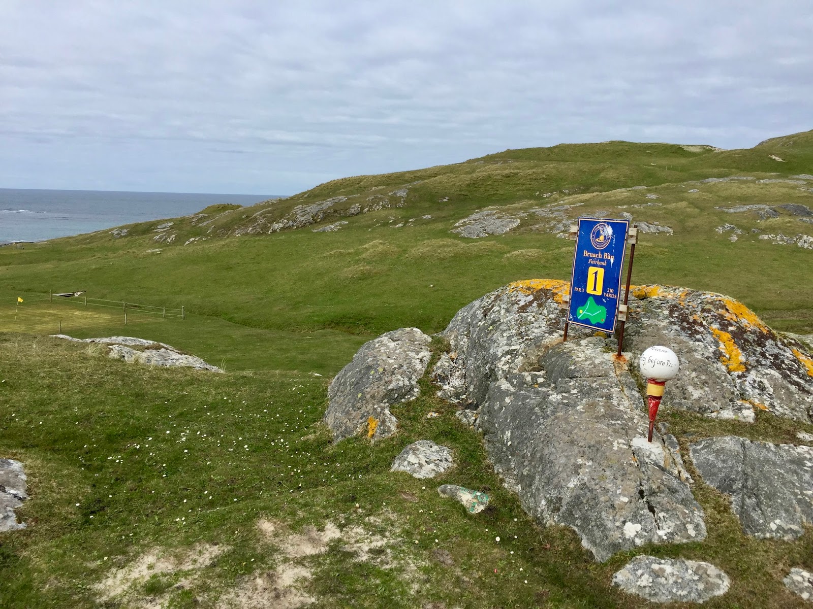
Also worthy of your attention is the Barra Golf Club. Situated on the side of the hilly Croc an
Fhithich with splendid sea views to both the north and south. Because it is on
common land there are electric fences around the nine greens to keep animals
from depositing their waste therein. None of the normal golfing facilities
exist, only two containers one of which is full of what looks like old grass
cutters and rubbish, the other one has an 'honestly' book in the side where golfers
post the ten pound for a days play. To reach this rather out of the way
facility head west from the Northbay junction until you see a sign for the golf
course and follow the narrow winding road until the cattle grid and when you
see the blue container - you've arrived. We were informed that even with a lack
of facilities the golf club is very popular with both tourists and locals.
 |
| Barra Golf Club. |
The islands of the Outer Hebrides offers visitors room to breathe and think
about life in general. It also reminded me of days gone by; the community
spirit that still exists on the islands, with its hard but simpler way of life.
The friendliness of the people on the islands where complete strangers wave and
say hello, where nothing seems too much trouble. The conversations with fellow
travellers who because of what you have in common lead to an exchange of travel
experiences. The Western Isles natural beauty takes your breath away at every
corner you turn, every island you visit, and every road you go down there’s
something new and exciting to discover. There
is almost no commercialism or fast food outlets, in fact there ain't that many
shops but the supermarkets that are on the islands are well provisioned and you
will find every thing you’re need. Unusually there are very few drinking establishments,
which really makes the islands so wonderfully different from the Scottish
mainland. Religion is still treated with reverence something that tends to be
thought of as rather old fashioned in our secular society, in some places you
can not buy a Sunday paper until Monday! The draw backs are the inaccuracies of
post codes, don’t rely on your sat-nav, and the wind, which in all honestly
never really stops but something you grow to except after a comparatively short
time. But when the sun shines you would have to go a very long way to find such
beautiful and truly breath-taking scenery.