To get to ‘the most westerly point of mainland Britain’ you have to
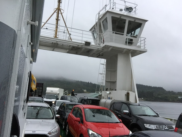
follow the A82 heading for Fort William but cross Loch Linnhe by a vehicle
ferry from Corran to the Ardgour peninsula and then navigate 30 miles of narrow
track road to the main village in the Morvern area Loch Alainn from where you
can get a ferry to Fishnish on the Isle of Mull and were Silica is mined
locally. The village has a snack bar, post office and a small shop. Fiunary is
a further 5 miles to its east on an even narrower road. Although other vehicles
are scarce care must be taken because sheep freely roam the area.
 |
| Corran/Ardgour Ferry. |
 |
| Loch Alliann. |
When you finally reach the end of your journey you will find the small Fiunary Camping Site beautifully situated on the edge of the Sound of Mull an 18 mile long channel which is 3 miles at its widest point and separates the Island of Mull from the Morvern mainland peninsula and on a good day offers great view’s of island.
 |
| The view across the Sound of Mull. |
Our four nights at Fiunary Caravan and Camping Park were some what spoilt by the constant rain night and day, in fact the wind and rain lasted for over 60 hours non stop! Still the rest and relaxation were most welcome.
The site is advertised as a ‘Hideaway’, which means it’s small, remote
and secluded and that it certainly was. Run by the very helpful Mr and Mrs
Henderson the site, although very basic, has all the normal facilities.
On the final full day of our stay the rain finally stopped - well
almost! So a walk was in order. Leaving the camp site and turning left along
the very narrow B849 we came across Clach na Criche or The Wishing Stone which
is a rock wall with a large 'hole'. Local people believed that the volcanic
rock granted wishes to anyone able to pass through its hole without touching
the sides, not an easy task. Clach na Criche means boundary stone in Gaelic and
was created about 60 million years ago when molten magna was pumped from the
heart of the Mull super volcano through cracks in the Earths crust. Legend
suggests it once marked the border between Pictish and Gaelic lands and later
between medieval church parishes.
Also to be seen along with the Ferry's, sailing boats and various other
craft was a fully functioning fish farm.
Further along the road is Killundine Castle a strange picturesque historic
ruin that was built in the second half of the 17th century and can
be described as being a mixture of a tower house and an unfortified residence.
The building was originally three storeys high and was constructed out of locally
quarried materials. It is thought that
the castle was built on the instructions of Allan MacLean who is on record as
being the tacks man of Killundine in the 1670’s. Apparently it was seized from
the MacLean’s by a party of militant Camerons during the first Jacobite Rising
of 1719 but was surrendered soon after on being attacked from the sea by a
government gunboat. The castle is known locally as The Castle of the Dogs, some
say because the MacLean’s used it as a hunting lodge others say it was
derogatory term used by the enemies of the Clan MacLean. Unfortunately access
to the castle itself was impossible.
A visit to this area is a perfect antidote to the rush of modern life.
You can feel the tensions ebb away. A place of peace and tranquillity and no Internet
– well nowhere’s perfect, or is it?
The last easily accessible wilderness left in the UK.


We have been to the area several times, so sorry about the weather we have had glorious weather there mostly, we loved seeing the pine marten coming to feed at the table and the otters in the evening.Lovely people the Hendersons, its been a few years since we were last there I thought they might have retired ! you have fired us uo to revisit in our T4 VW wheres the midge nets !!
ReplyDeleteThanks for your comment. Glad the blog encouraged you to think about revisiting the site.
Delete