
A return trip to Ireland was called for as we felt our last road trip in 2023 did not take in all we wanted to see. This 2024 trip was again to visit both Northern Ireland and the Republic having planned to visit 9 campsites in the Republic of Ireland a two sites in Northern Ireland. The big difference between the two is that NI is, at present part of the United Kingdom and the more prosperous Republic is part of Europe, which obviously has differing travel rules and restrictions along side the fact that the currency is Euros and of course the food in the supermarkets is cheaper than Scotland, which would not be the case if we had not been forced out of Europe against our will.
Choosing camp sites to stay on is pot luck, never knowing what your find until you arrive! After leaving the busy Ferry Port in Belfast we headed south towards Dublin for the first of what turned out to be nine stopovers in the Republic, leaving two campsites in NI until last, before returning to Belfast for the Ferry back to Cairnryan.
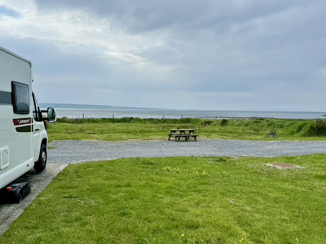
Gyles Quay, Riverstown, Dundalk, Co.Louth.


This site, just shy of the Irish border, overlooking the the Irish sea at Dundalk Bay, is nestled in the Cooley Peninsula at the foot of the Mourne Mountains. Its got a small reception shop and Fergusons Bar/Restaurant, very clean showers and toilets. Not a big site, which included pods, and was very busy at the weekends.

Our first full day included a 20 mile return cycle ride into the town of Carlingford, the only problem was the route was along the busy R173, with only small sections of a ‘yellow lined’ bike path.


The vibrant little village of Carlingford is sited on the side of Carlingford Lough amid medieval ruins and quaint whitewashed houses and shops. After eating our piece in the shadow of the Old Railway Station a visit to Ruby Ellens Tea Rooms located in a charming cottage with eggshell blue walls, mismatched chairs and lace tablecloths was required for some take-away hot drinks.

King Johns Castle, also known as Carlingford Castle, is located above the towns harbour, with its west wing built in the late 12th century by Hugh de Lacy Lord of Meath shortly after the Norman invasion of Ireland and has a long history protecting the Lough and the trade route to Ulster. Unfortunately the castle is closed to the general public, but at certain time guided tours can be arranged. Decided to cycle back, where possible, on side roads but not always possible. The diversion gave us a chance to see some of the areas beautiful countryside.

From the caravan park you can walk east along the shore towards Templetown but only as far as a very fast flowing burn, but a lovely spot to eat our piece all the same.

Final day involved another cycle trip, this time up a steady 7 mile climb to the Long Woman’s Grave at Corrakit in the Cooley Mountains.
The official story of the grave is as follows:
Lorcan O Hanlon was the youngest son of the “Cean” or Chieftain of Omeath. His father, upon his deathbed, ordered that his lands be divided between his two sons, Conn óg and Lorcan.
However, Conn óg tricked his brother Lorcan by bringing him up to the Lug or Hollow in the mountains at Aenagh, telling him that he would give him the land “as far as he could see”. The mist and the bleakness of the hollow was Lorcan’s only legacy (as the walls of the hollow blocked any sight of the surrounding land).
However, Lorcan owned a ship and began trading in the East, making his fortune and becoming prosperous. On one of his voyages to Cadiz, he bravely saved the lives of a Spanish nobleman and his daughter. Lorcan was enchanted by Cauthleen, a Spanish descendant of the great O’Donnells of Ulster and he fell in love with her. The pair made a handsome couple as she was 7ft tall, only three inches smaller than Lorcan.
Cauthleen was already engaged to be married but was wooed by Lorcan’s professions of love and the promises of the the good life they would have back in Omeath. The pair eloped. When the couple arrived in Carlingford Lough the locals were enchanted by this tall beauty adorned with jewels.
The couple set along the mountain path until they came to the Lug or Hollow in the rocks. Lorcan bade his bride to stand in the centre and look around as far as she could see as he “Was Lord of all she could survey”. Cauthleen looked around, so great was her disappointment at the realisation of what she’d left behind in Spain, she fell to the ground and died.
Lorcan was horrified that his duplicity had caused his wife to die and flung himself into the murky waters of the marsh at the crossroads. His body was never recovered. The locals found the long woman’s body and dug a grave for Cauthleen in the “Lug Bhan Fada” (Long Woman’s Hollow) where she lay. Each person laid a stone on the grave to raise her burial cairn and here she sleeps today in the hollow of her disappointment and unfilled promises.

A walk up the hill at the rear of the grave was well worth while to see the surrounding countryside.


But more interestingly was the memorial bench situated at the side of the area. This was to commemorate a legend within the IRA . Brendan Hughes (June 1948 – 16 February 2008), also known as "The Dark",and "Darkie" was a leading Irish republican and former Officer Commanding (OC) of the Belfast Brigade of the Provisional Irish Republican Army (IRA).[5] He was the leader of the 1980 Irish hunger strike.


Return cycle ride was down hill, so quite pleasurable, and a lot quicker.
Redcross, Co.Wicklow.

The River Valley Holiday Park is approximately 20 miles south of Wicklow, and is a large site suitable for families because of all the activities that are on site. Flannagans Walk around the perimeter of the site gives you a chance to see whats activity's are available. Our pitch was in the “Secret Garden” an adults only section that has serviced pitches and its own amenity block.

Although a small village, Redcross it self has a well stocked shop and a pub/restaurant called Mickey Finns.


The following day its rained nearly all day which limited our own activities, but gave us a chance to organise a taxi to take us into Wicklow. Very impressed with the town, some decent shops and some landmarks to explore.


First up was Wicklow Gaol, opened in 1702 and was notorious throughout Ireland for the brutality of its keepers and the harsh conditions suffered by its inmates. Prisoners were held during the 1798 Rebellion and the Great Famine, as well as many held there prior to penal transportation. Originally closed in 1900, but reopened in 1918 to hold republican prisoners during the Irish War of Independence and the Irish Civil War. The last inmate left in 1924. Reopening as a museum in 1998. There is a grand restaurant situated in the Gaol, from which we treated ourselves to lunch, good food and price.


After leaving the Gaol head down to the harbour and then up to the site of the Black Castle. This castle ruin stands on a rocky promontory over the sea, at the eastern side of the town. Following the arrival of the Norman’s in 1169 Earl Strongbow was granted the lands along the East Coast. He in turn granted those lands to Baron Maurice Fitzgerald on condition that he build castles for protection. The Black Castle was constantly under attack from local Chieftains, notably those of the O’Byrne and O’Toole clans and in 1301 they succeeded in totally destroying the castle. There is a fine vantage-point for views over the town and the coast of North Wicklow from the ruins.


Walking back through the town ready to meet our taxi, we just had enough time to visit the beautiful St Patricks Church and light a candle. The church was completed by voluntary local labour in 1844 on a site provide by Earl Fitzwilliam. A 4 ton bell was installed in 1889.

The following, and final full day at Redcross, we walked the 4 miles to the huge granite boulder known as the Mottee Stone. This well known landmark is said to weigh about 150 tons, we had no way to prove that of course! From the stone it is said that the five counties surrounding Wicklow can be seen on a clear day. Folklore has it that the stone was the hurling ball of the great Fiona Mac Cumhaill. Iron rungs have been embedded into the stone to act as a ladder, which allows you to climb the 2.4 metres to the top.
Sixacre, Tagoat, Co.Wexford.
The weekend we moved on from Rosecross turned out to be a very busy Bank Holiday Weekend! Therefore our first choice of campsite was not available. We hastily booked another site that turned out to be very much below standard, so for the first time we asked for our money back, which we got.

Third choice site was a three night stop at the International Outdoor Adventure Centre. This was a very large site mainly for youth groups that made use of tents rather than Motorhomes and caravans. The biggest problem, following some very heavy rain, was that most of the fields were waterlogged so we had to pitch up on the roadway opposite the pitches.


A local bus took us into Wexford Town the following day. Problem, we could not get back the same way because the bus we were due to catch had a puncture! Due to the kindness of others we were able to share a mini bus and eventually got back to the IOAC. Wexford is not the most exciting place to visit, although we had a very tasty fish supper at Sharky’s in Church Lane. Along side the stalls in the market square a lively line dancing demonstration was taking place by some very enthusiastic ‘Dancing with Declan’ members. Tried to get into the the 12th century Selskar Abbey, but that was closed had to make do with some rather beautiful wall art and what was left of the town wall.


Three miles from the campsite is the serene Our Lady’s Island. The island hs been the centre of Marian devotion and pilgrimage since at least the 6th century. Said to be the oldest Marian shine in Ireland it is certainly is an area of unparalleled beauty were nature converges with the pilgrims who walk the loop around the Island nine times, a walk interspersed with the Stations of the Cross culminating in a Garden of Resurrection.


Balllinacourty Dungarven, Co. Waterford.


We were very impressed with the town of Dungarvan and its picturesque harbour, where the River Colligan meets the sea, some lovely shops, restaurants coffees shops and public bars. St Garvan founded a monastery here in the 17th century, but most of the centre dates from the early 19th century when the Duke of Devonshire rebuilt the streets around the towns Grattan Square.

Overlooking the the bay is the ruined 12th century castle.
The castle has been described as Anglo-Norman, and was founded in 1185 by Prince John, on the mouth of the Colligan River. It was amongst a number of castles built around this time in the south east of Ireland. The castle was used as a barracks during the Irish Civil War, then taken by the IRA who upon leaving in August 1922, set fire to the structure. After the foundation of the Garda Síochána in the Free State, the castle was restored and became the local Garda Station until 1987. After 1987 the castle fell into disrepair again, but under new management it was restored and now provides guided tours, an exhibition and an audio-visual show on certain days.


Bayview, our Caravan and Camping Park was a part of the Gold Coast Holiday, Golf Sports Resort offering various sports facilities at concessionary rates but because of the close proximity of the ‘Waterford Greenway’ we did find the need to use them.


The Greenaway is a 46km off road cycling and walking trail that was originally the railway line between Waterford and Dungarvan sections of which we made use of with our bikes including our ride into Dungarvan it self. Also we traveled to the historic Ballyvoyle Viaduct which was blown up in 1922 during the Civil War and rode through the atmospherically lit 400 metre long Ballyvoyle Tunnel.


Another worth while cycle ride is to Clonea Strand, a lovely 1.8km crescent of golden sand with beautiful views and scenic walks. This Blue Flag beach seems to be very popular, even out of season. Enjoying your piece overlooking the sea is always a pleasure.


From the site there is a rather nice walk to the Ballinacourty Lighthouse from the campsite and another chance to see the splendid coastal views.
Skibbereen, Co. Cork.

The Hideaway Camping and Caravan Park was certainly one of the better sites we stayed at on the 2024 Trip. Conveniently situated within a short walking distance of the town of Skibbereen, the site was well run with decent size fully serviced pitches and very clean facilities. Not forgetting the very helpful Leanne for whom nothing was to much trouble.


Skibbereen is a most interesting place to visit with its fair share of history. The best way to see everything is to follow the three interlinked loop walks around this lovely market town. To understand the tragic story of Irelands Great Famine of the 1840s in one of the worst affected areas in all of Ireland, a couple of hours spent in the Heritage Centre is well worth while.


Follow this with a visit to the rather sobering Abbeystrowry, the site of an old Abbey dating from the 13th century where you will also find the Famine Pits where it is estimated that between 8000 and 10000 famine victims were interred between 1845 and 1850.

The Town Hall was erected in 1863and rebuilt following a fire in 1955.


Next to the Town Hall is Maid of National Monument dedicated to dedicated to heroes of Irish rebellions against the British.

St Patricks Cathedral built between 1826 and 1830.

Dating from the 1820s is the Skibbereen Courthouse.

Rossa Park opened in 1950 in honour of the Irish Patriot and Fenian Jeremiah O’Donovan Rossa (1831-1915) who lived and worked locally.

The relatively new St. Patricks Cemetery is situated at the western end of the town, across the IIen River from the Abbeystrowry Cemetery.

This water tower and the crane is the only proof that this was the site of the Cork, Brandon and South Coast Railway Station which operated from 1877 to 1961.
Doonaha, Kilkee, Loops Head Peninsula, Co. Clare.


To reach our next camp site we decided to make use of the Shannon Ferry from Tarbert to Killimer, a 20 minute sailing which cut our journey by over 30 miles.
We originally planned to stay on the Green Acres Caravan and Camping for 4 nights but on arrival altered it to 2 nights only. As you can guess we were not impressed.


As well as the site not being up to standard there was nothing very exciting to do just a wee walk to Glasheen Beach and the Church of the Holy Spirit.
Cong, Co. Mayo.

Another of our favourite campsites on the 2024 Trip was Cong Camping and Caravan Park located a leisurely 15min walk to the very picturesque village of Cong. The owners of this site were a great example of the Irish humour and friendliness that underlines our experience of travelling through Ireland. A very well maintained site, showers and toilets are pristine with excellent disabled facilities. A site well recommended to be included on anyones touring inventory.

There are a number of things that make Cong a grand visiter attraction. Firstly it conjures up a romantic notion of the traditional Irish village as nothing much has changed over the years since the making of a classic Hollywood movie in the 1950s.


John Fords 1952 Oscar winning film The Quiet Man was filmed in the village and in the ground of the nearby Ashford Castle. There is even a life size statue to commemorate its two main stars, John Wayne and Maureen O’Hara. in Cong.


Also there is a Quiet Man Museum and gift shop, both well worth a visit. The museum building is is modelled on the White o’Morn Cottage featured in the movie.

Interesting facts regarding the making of the film. When making the movie in the summer of 1951, the weather was so good that a fire tender had to be used to create a rainy day. (Certainly not our experience of Irish weather) Most of the extras in the movie were locals and were each paid 30 shillings (£1.50) per day. The average weekly wage at the time was 50 shillings (£2.50) Electricity came to Cong for the first time in 1951 because John Ford was making the film that year. It could have been five to six years later otherwise.

A short cycle ride down to the Lough Corrib quay were we pick up the Isle of Inisfree for our boat trip around Lough Corrib finishing at Ashford Castle.


Fortunately the day was lovely, sunny and dry, so we were able to sit out on the deck and really enjoy the scenery on offer. The Lough is the largest in the Republic of Ireland and covers an area of 68 square miles. It is said that there are 365 islands on the Lough, one island for each day of the year. Very few of these are inhabited.

The most famous of these is the Inchagoill Island, were at one time six families lived and because we are in Ireland you will find the remains of The Church of the Saints, built by the Augustinian Monks of Cong circa 1180 A.D. At certain times there are trips to the Island.

Another famous local landmark is Ashford Castle which was a medieval and Victorian castle that has been turned into a five star luxury hotel that bridges two Irish counties County Mayo and County Galway. First built as a Norman Fortress in 1228 as the seat of the de Burgo family.


During the famine years 1847-1852 the castle fell into disrepair as the tenants on the estate were simply unable to pay the exorbitant rents. By 1852 the owner at time declared himself bankrupt and was forced to to put he estate up for sale. It was at this time that the famous brewing dynasty, Guinness, purchased the estate. The Guinness Family spent a million pounds renovating the the castle between 1875 and 1915 returning it to its former glory. Various owners followed and at present is part of the Red Carnation Hotels organisation.


Other items of interest were the weathered shell of the 12th century Augustinian Abbey.


The Cong Dry Canal, which we discovered was unfortunately very over grown, was to combine drainage and navigation and in 1848 Samuel Roberts was appointed as superintending engineer for the project and work on the panel began immediately. For five years both skilled and unskilled workers were paid 4p per day to blast their way through 4 miles of solid limestone rock. Because of the porous nature of limestone the scheme was to become an engineering disaster because the bed of the canal proved too porous and was unable to retain water. The work was discontinued in April 1854.

We really enjoyed our stay in Cong added by some decent weather and plenty too see and do, but time to move on.
Strandhill, Co. Sligo.

At this point in our trip we had 3 spare days so decided to head for Standhill Caravan and Camping Site which is situated opposite sand dunes that lead down to the Atlantic Ocean.

Its the rolling waves that make the long red-gold beach a principle draw for surfers. The sea front has various surf schools and and places for surfers to stay.

But for us the big draw was Mammy Johstons Ice Cream Parlour.


Killaspugbrone church dates from approximately 1200 AD, however like many other sites a religious building has stood there since the 5th century. Originally the church was flanked by a small village until the early 19th century when it was engulfed by the surrounding sand dunes.

The graveyard which surround the church is multi-denominational and was used until the 1960s. It is estimated that there are some 700 graves many of which do not have headstones.

Facilities on the campsite were kept very clean, although the pitches were a wee bit higgledy-piggledy, but i would certainly recommend this camp site.
Roshin, Killybegs, Co. Donegal.


Killybegs Holiday Park is certainly a unique camp site. It has seven terraces carved out of a very rocky hill, in stages, by the owner. It looked like it was built out of a quarry, but this was not the case. Massive pieces of stone bordered each terrace. Facilities were on two of the levels, the lower block was new. This site catered for all types of camping including green areas for tents. All pitches had electric and most had water and drainage.


A 20 minute walk from the campsite will take you into Killybegs, the largest fishing port in the Republic with its giant trawlers and vessels and a very tasty fish supper at the Marina Cafe.

Finally it promised to be a good day so we decided to explore the area on our bikes. First stop was the marina at Portnacross situated along an inlet of Donegal Bay adjacent to a area of scenic beauty and rugged coastline.


From here we cycled to Fintragh Bay, some of which as along a very busy road, said to be the best beach in the Killybegs area, it turned out to be well worth the ride. This Blue Flag beach is certainly worth your time, and a lovely spot to have your piece on a fine day.
Derry, Co. Londonderry.


It was important to us that we stayed within a reasonable distance of the town of Derry and the nearest site was the rather basic Motorhome stop over offered by the Groarty House and Manor Bed and Breakfast. A twenty five minute walk took us to a bus stop which took us directly into the Derry Bus Station. Although our first planned visit was curtailed some what as the external motorhome lights were giving problems, but a nice gentleman from the RAC sorted out our problem next morning.

Derry is Northern Irelands second largest city and offers the visitor a great deal of history to enjoy. It also is a city with two names. Nationalists always use Derry and and the London part of the name is often crossed through on road signs. Some staunch Unionists and loyalists insist on Londonderry, which is still the city’s, and the County’s official name.

To make the best of this fact we decided to take one of the tours on offer.
Martin McCrossan City Walking Tour covers the background of the city’s history including Emigration , The Plantation and The Siege.This one hour tour takes you up on to the city historic 400 year old walls from which we see some of the oldest building inside the walled city. We also learn about the Derry Apprentice Boys and the marching traditions in the city. The tour runs four times a day and cost £6 per person. Our guide was John, who we were told had been doing these tours for twenty years.


The Guildhall, the seat of Old Londonderry Corporation which institutionalised the discrimination against Catholics and in turn was bombed twice by IRA.
The Apprentice Boys of Derry is a Protestant fraternal society with a worldwide membership of over 10,000, founded in 1814 and based in the city of Derry, Northern Ireland. There are branches in Ulster and elsewhere in Ireland, Scotland, England, Australia and Toronto, Canada. The society aims to commemorate the 1689 Siege of Derry when Catholic James II of England and Ireland and VII of Scotland laid siege to the walled city, which was at the time a Protestant stronghold. Apprentice Boys parades once regularly led to virulent opposition from the city's Irish nationalist and republican majority, but recently a more conciliatory approach has taken place and now the parades are virtually trouble-free. The 2014 'Shutting of the Gates' parade was described as "the biggest in years" and was violence-free.

Derry is the only remaining completely intact walled city in Ireland, and one of the finest examples of a walled city anywhere in Europe. The walls constitute the largest monument in State care in Northern Ireland and stand as the most complete and spectacular.
The Walls were built in 1613–1619 by The Honourable The Irish Society as defences for early 17th-century settlers from England and Scotland. The Walls, which are approximately one mile (1.5 kilometres) in circumference and which vary in height and width between 3.7 and 10.7 metres (12 and 35 feet), are completely intact and form a walkway around the inner city. They provide a unique promenade to view the layout of the original town which still preserves its Renaissance-style street plan. The four original gates to the Walled City are Bishop's Gate, Ferryquay Gate, Butcher Gate and Shipquay Gate. Three further gates were added later, Magazine Gate, Castle Gate and New Gate, making seven gates in total. The architect was Peter Benson, a London-born builder, who was rewarded with several grants of land.
It is one of the few cities in Europe that never saw its fortifications breached, withstanding several sieges, including the famous Siege of Derry in 1689 which lasted 105 days; hence the city's nickname, The Maiden City.


After the tour, and following a recommendation from Charlene, we went to Claude’s Cafe for some very welcome lunch. Claudes takes its name from the well known Derry solicitor Claude Wilton. The tag line “say nothin’ ’til ye see Claude” has become a well known Derry saying. The name Claude was an old nickname of the current owner.
Bogside.
(For Photos see end of writeup)

One of my main reasons for visiting Derry was to visit the city’s Bogside area. This predominately over crowded walking class and Catholic residential area was beset by poverty and unemployment following the famine of 1840s and the fact that Catholics were forbidden from living inside London Guilds financed wall. Although there was more Catholics than Protestant's in Derry the Catholics were treated as second class citizens, only allowed a vote in local elections if they owned their own property and discriminated in the job market in favour of the Protestants. Because the Westminster government ignored this discriminatory treatment nothing was done to elevate the problem if it had been the Troubles would not have happened.
In the 1960s a Civil Rights Movement was formed. But by the late sixties the London based government was forced to take notice after the three day Battle of the Bogside in August 1969 between local youths and the Royal Ulster Constabulary. There answer was to draft in British Troops which the Catholics originally thought were brought in to protect then against the RUC and the B Specials, history tells that was short lived.
Following what turned out to be a heavy handed move by the British government the residents of the Bogside to set up ‘Free Derry’ declaring themselves independent of the civil authorities and barricaded the streets to keep the army and the police out. The streets were patrolled by none armed volunteers.
Then things got far worse. On Sunday 30 January 1972 the Northern Ireland Civil Rights Association organised what was supposed to be a peaceful march against ‘internment without trial’ 15000 people marched from the Creggan down through the Bogside. The British army could not leave well along so the marchers faced barricades. Near Free Derry Corner at Rossville Street the soldiers of the 1st Battalion, Parachute Regiment opened fire on unarmed civilians murdering 13 innocent marchers some of which were shot in the back while fleeing, a 14th person died from injuries sustained some months later, many others were injured by gunshots and from being knocked down by the armoured personnel carriers. As i have said original the army was supposed to protect the Catholic population from Protestant violence and persecution but the residents of the Bogside area now saw the troops as their enemy and an occupying force. It was due to this that the ranks of the Irish Republican Army were swelled with a fresh surge of volunteers and grew into a unique fighting force.


Free Derry Corner, where on the end gable of what remains of a row of terraced house is painted is the world renown slogan 'You are Now Entering Free Derry'.


Bloody Sunday Memorial, which commemorates the 14 peace marchers where shot dead by the British Army on the 30th January 1972.


Hunger Strikers Memorial.
There follows some of the Murals Known as the Peoples Gallery:

Operation Motorman showing a British soldier breaking down a door with a sledgehammer.


Bloody Sunday, shows group of men carrying the body of Jackie Duddy, the first fatality of the day.

The Petrol Bomber.

Death of Innocence, shows the figure of 14 year schoolgirl Annette McGavigan killed in crossfire between the IRA and the British Army on 6 September 1971, the 100th victim of the Troubles.

Peace Mural, a swirling image of a dove rising out of the blood and sadness of the past towards the sunny yellow hope of a peaceful future.


The Widgery Report set up in 1972 put no blame on the soldiers for killing the innocent peace marchers and was proved to be a whitewash. But following the unbiased Saville inquiry published in 2010 this decision was reversed and put the responsibility for the deaths squarely on the Parachute Regiment forcing the British PM to publicly apologise. In 2019 one and only one, member of the Paras was charged with murder.
Walking through the Bogside, talking to folk and visiting The Museum of Free Derry you still can feel the resentment. In 2019 rumblings of unrest returned. In January a car bomb was detonated outside the courthouse on Bishop Street. In the following April journalist Lyra McKee was killed in gunfire during a night of rioting in the Cretan Estate. The New IRA acknowledged responsibility and apologised to her family. It does not help that there is indecision about prosecuting the soldiers responsible for the killing during the Peace March on Sunday 30th January 1972.

Six Mile Water Antrim Co. Antrim.


Our final stop before returning home was at the council run camp site that is part of the Lough Shore Park. The Six Mile Caravan Park has just 37 electric hook up pitches all of which include your own water supply and drainage and are set out on hard standing bases. As there is no permanent staff on site your given an your own barrier number and a pitch number when booking - you just can’t turn up. The facilities are regularly cleaned and well maintained.
The caravan park is within easy walking distance of the Antrim Castle Gardens, Antrim Town and of course Lough Neagh.

Lough Neagh is the largest freshwater Lake in the UK covering 383 square kilometres.

The Protector of the Lough statue towers over the Lough. At six meters high it can't be missed. It depicts the legendary Finn McCool, made of stainless steel ribbons which gently move with the breeze, creating the illusion that this giant of a man is in the act of throwing a boulder at his rival, Benandonner.

Continuing along the shore we walked the Antrim Town Loop, through Reas Wood Nature Reserve and then inland via Kirbys Lane and some lovely countryside. Reaching Six Mile Water a path takes you into Antrim Town along a section of the Mill Race Trail. Returning to the campsite via the grounds of the castle gardens.

You can't possibly visit this area without taking in the Antrim Castle Gardens. The gardens are one of the only two genuine late 17th century Anglo Dutch water gardens to survive in Ireland, and one of only a handful survive in the British Isles with their main original features still intact. It was laid out around the Antrim Castle in the late 17th and early 18th century with further additions in the mid 19th century.


Water played a major part in the gardens with two Long Canals complete with Cascades, and a Round Pond.
The whole site was planted with trees to create a wilderness complete with paths and avenues joining up all the main features:

Parterre Garden which was recreated in 1991.

At the entrance to the town is the Barbican Gate Lodge.

An Italianate Tower, standing as the only remains of Antrim Castle. The castle itself was destroyed in a fire in 1922. A small amount of ruins are still visible.

The ancient Norman Motte is the central feature of the the site.


Clotworthy House, now only a coach yard and stable block built in a Dutch style in the 1840s. It also features a nice restaurant. Hot Chocolate and cake are recommended.

The county town of Antrim, like a lot of UK towns is a wee bit run down, but the restored Georgian styled Old Court House is worth a look.

Part of the town is the Scotch Quarter reflecting the the fact that most people living in the town moved here from Scotland and therefore has been the home of Presbyterian worship in Antrim since the 1620’s.

First Antrim Presbyterian Church.
So much history in Ireland, both north and south. Have enjoyed our second stint in this lovely country especially our visit to Derry and the Bogside and hope to one day return. Ireland is so much stricter about overnight parking for Motorhomes with restrictions and height barriers to encourage people to use official campsites. Something Scotland will have to adopt if they are going to discourage the freeloaders.
No comments:
Post a Comment