
Our latest trip did not
really start until we had completed a three-night stay in Dalkeith to look
after our three grandsons, always enjoyable - but hard work! On Monday
6th May we left for the Aberdeen’s Ferry Terminal to catch the overnight
NorthLink boat to Lerwick. This outward 12 hour journey was aboard the MV Hrossey a very
comfortable vessel, made even more luxurious by booking an outside 2-birth
cabin that in turn gave us access to the Magnus Lounge with its free concessions.
Under this deal you are allowed to take your vehicle off the ferry when it
docks and return to the boat to enjoy a free and leisurely continental
breakfast. A nice relaxing start to our holiday.
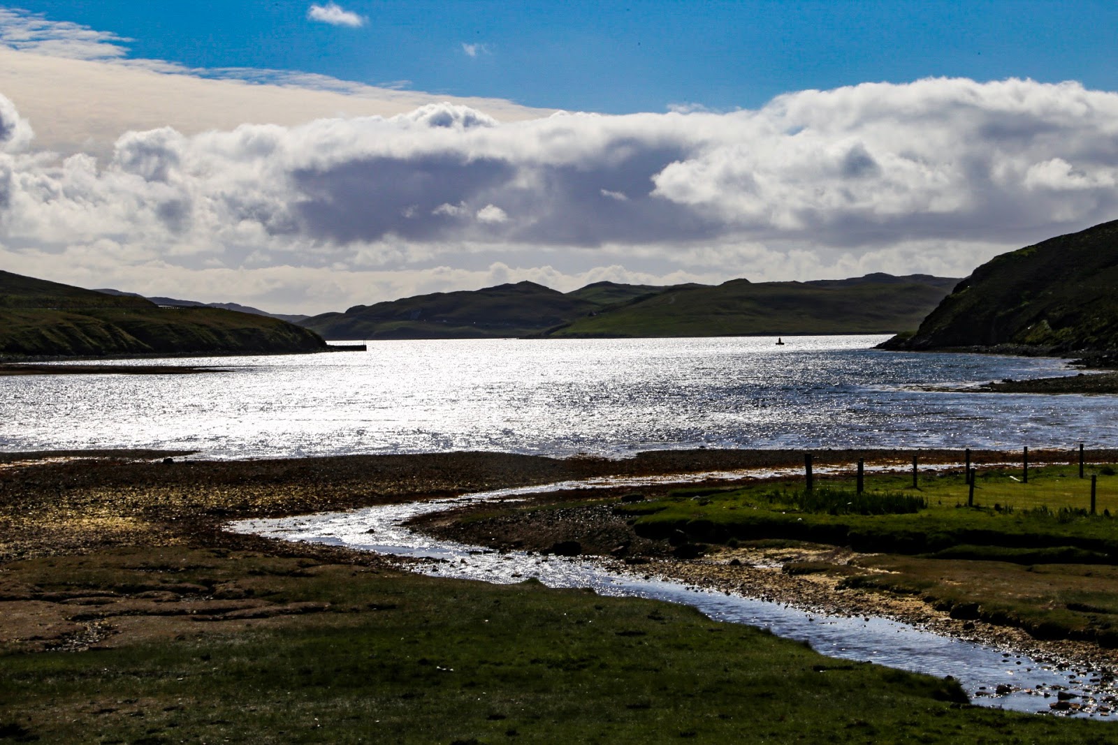
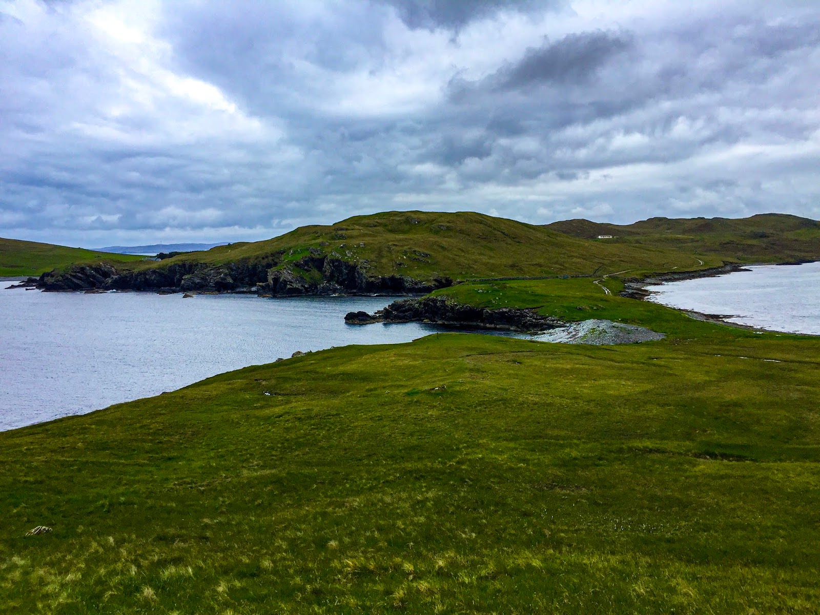
Mainland - Levenwick.

First stop after arriving
at Lerwick was to call in to the large Tesco Superstore to stock up with
supplies and then head south towards Sumburgh for our first stop over. We had
the usual problem with the postcode lottery, this one was at least 3 miles from
our final destination, which made the site difficult to locate.

Eventually Levenwick
Community Campsite turned out to be just of the Lerwick to Sumburgh main road
and was situated in the grounds of a community hall. Quite small with only 12
tent pitches and half that number of touring pitches, its main attraction is
the panoramic views including Levenwick Bay’s sandy beach and its beautiful
clear shore line.


An afternoon walk down to the beach involved four changes of
weather, sunshine, rain, sleet and believe it or not a heavy downfall of snow -
let’s hope this is not an indication of the weather to come over the next five
weeks? The following morning we
woke up to a lovely sunny morning after, one must admit, a very cold night. The
scenery is even more stunning when the sun decides to put in an appearance.


In the 19th century Lerwick
became Shetlands capital city and takes its name from the Old Norse Leirik
meaning muddy bay, why it was referred to by this name is anybody’s guess as
the sea around the towns various harbours is crystal clear. The town growth,
like many other Scottish towns, was due to its trade from the herring industry.


There is plenty for the
visitor to see, places to eat and drink coffee. Therefore out first port of
call after embarking from a 45 minute journey on the number 6 bus from
Levenwick was the contemporary designed Mareel the towns new art centre. It
doubles as a cinema, with two screens and a music venue for live concerts it
also has a cafe bar where we enjoyed coffee, hot chocolate and cake.


Commercial Street is
Lerwick main street running parallel with, and the length of, the port. It
boasts many fine shops including the famous Shetland Times Book Shop.


Streets known as the Lanes
run off at right angles and are full of character.

The neo-Gothic Town Hall
was designed by Alexander Ross and completed in 1883. This beautifully preserved buildings stained
glass windows remind us of the cultural links to Scandinavia.


Across the road from the
Town Hall are the Country Buildings that houses the sheriff court and the
Police Station whose facia I believe was used in the BBC’s Shetland series.

And why we are talking
about Jimmy Perez, at the south end of Commercial Street you will find the Lodberry
that was also used in the BBC series. This building was originally used to
bring boats alongside to load and unload both legal and illegal goods.


One of Lerwick most famous
inhabitants was Arthur Anderson who was born in 1792, and became chairman of
the Peninsular and Oriental Steam Navigation Company (P&O) he also built
homes for the widows of seaman.


Fort Charlotte built
between 1665 and 1667 by the master mason of Charles the Second, John Mylne, to
defend the strategic Bressay Sound anchorage from the Dutch and later the
French war ships. Burned down by the Dutch in 1673 and restored in 1782 when
Britain faced a serious navel threat during the American war of Independence.
Interestingly in 1868 the fort became home to 465 German migrants after their
ship was wrecked off Shetland. Local people cared for the families until they
could complete their journey. An Army Reserve Unit is still based at the Fort.


Our next wee trip involved a15 minute boat trip on the M/B Solan IV piloted by the very friendly and informative pairing of Mr Jamieson and his son from the pier at Leebitten which is just below the village of Sandwick, which took us to the uninhabited Island of Mousa to see the best preserved example of an Iron Age Broch which can only be found in Scotland.


This impressive dry-stone round tower is over 42 feet high and has a diameter of 50 feet at the base. The best guess for its construction is possible around the 1st century AD. Its hollow wall conceals a very narrow staircase, which is reputed to be the oldest staircase still in existence. Although the climb up to rampart walk is a wee bit precarious, it’s well worth the effort - torches are provide!


The island is a RSPB nature
reserve and its well worth your while to enjoy a walk around the island making
sure you follow the way-marked paths to avoid the breeding ground birds and
their nests.

SS Murrayfield was an
armed merchant ship that run aground in 1942 while on a passage from Lerwick to
Newcastle during dense fog fortunately no lives were lost. Wreckage can still
be seen on the east side of the island.

Ham House is where
you land on the island. It was built around 1770 as a fishing booth associated
with fish curing.


The Haa is now a
large ruin but was once the home of James Pyper a Lerwick merchant who bought
the island and built the Haa to keep his first wife away from the evils of
drink. His second wife lived on the island after James death until her own
death in 1852. The last family left the island a year later and it has been
uninhabited ever since.


Ten miles south of the
Levenwick Campsite is Sumburgh Head the most southerly point on the Mainland.
Departing the number 6 bus at the entrance to the Sumburgh Hotel you can than
walk through the hotel car park passed the Jarlshof archaeological site around
the coastal path, which forms the nature reserve, and up to Shetlands first
lighthouse which now forms a wonderfully interesting visitors centre opened in
2014. It comprises an interactive Marine Life Centre over two floors, the
Lighthouse Tower, the WW11 Radar Hut, the restored Smiddy and of course the
Sumburgh Foghorn. (You Tube - Sounding
the Sumburgh Foghorn).


The Foghorn along with its
fully restored engine room and its “1951 Kevin K-Series Diesel 44hp Engines”
are featured in a new horror film that has attracted rave reviews at this years
Cannes Film Festival. The Lighthouse
is a psychodrama set in 1890s on a remote Atlantic Island off the North
American coast and stars Willem Defoe and Robert Pattinson.


Unsurprisingly Robert
Stevenson for the Northern Lighthouse Board designed the Lighthouse. Built by Peterhead contractor John Reid in
1821 and automated in 1991.


It’s at this location we
spotted the Puffins, the most recognisable of all the seabirds, on Shetland
they are known as Tammy Nories. Strangely they do seem to pose when they spot a
camera!


Up until this point we had
used the services of the bus but as our next adventure was not easily
accessible by public transport the bikes finally put in an appearance.


St Ninians Isle is a small
Island that lies off the southwest coast of Mainland Shetland just 4 miles from
Levenwick. It is reached by a quarter mile of white shell-sand known as a
tombolo that is not only unique to Shetland but also in Scotland and the rUK.
This was formed by wave action from opposing directions and only severe tides
could restrict your crossing.


A gorgeous walk around the
island awaited us. Up the west side of the island to Loose Head in the north,
back down the east side to see the ruined chapel where in 1958 a Shetland
schoolboy excavated a box of 28 Pictish silver objects which can now be viewed
in our National Museum in Edinburgh.
West Mainland - Skeld.


Sitting on a lovely
deserted beach at Westerwick in the unexpected warm sunshine with only sea
birds for entertainment is for me what life is all about. The beach was only a
three-mile bike ride from our new well-kept campsite on the marina at Skeld.
From the beach you can safely leave the bikes and wonder up and along the
cliffs to sample more bird life and if your lucky see some seals sunbathing on
the rocks. To be fair no picture can truly capture the beauty of the cliffs on
this coastline.


Like the Levenwick site
Skeld Caravan Park is run by volunteers and is a credit to the husband and wife
that look after it. Skeld is located on the south side of the Mainland of
Shetland just eleven miles from Lerwick.

A big attraction of this
area is the lack of people and traffic. The locals are very friendly as well as
being helpful, suggesting places to see and visit. Our bikes came in very
useful, as the bus service was almost non-existent.


One of the many places
recommended to visit was the Broch of Culswick. This involved a eight mile
return bike ride to Culswick and then a three mile return walk across some
beautiful wild countryside up to the unexcavated coastal broch situated on top
of a steep smooth knoll on a rock platform overlooking cliffs and the sea with
excellent views all around including Vaila and the Fair Isle. The highest point
of the broch is between 2.5 and 3 metres but a lot of the original stonewalls
have collapsed into the middle, which made a sheltered spot for our picnic. The
original entrance still has it’s impressive triangular lintel stone in place.


Just as we ended our walk
back to the bikes and below the wind turbines is a small simple stone building
that I thought would be part of the turbine set up, it turned out to be a
remote Methodist Church something you would never imagine from the outside and
one of the most surprising parts of our trip to date. Wood lined walls and
ceiling, it also had a beautifully carved 19th century Story and Clark Pump
Organ from Chicago USA. I would like to know the story behind that? Above the
red door a plague informed us that this Wesleyan Methodist Church was
originally built in 1893 on ground given by a Mrs R L Allan of Culswick.

On our ride back we
discovered that a wee lamb had been separated from its mother by a wire fence
and was fretting, so with a bit of cunning and using my school days rugby
training we managed to reunite the lamp with its mother - our good deed for the
day.


Before leaving Skeld we
wanted to explore two further locations. The first was Silwick where its stony
beach can only be accessed via surrounding farmland which is not a problem if
you have not a got a dog and make sure you close gates. Everywhere you go on
Shetland the Ewes are giving birth, this is later than on the Mainland, so in
May we found a lot of young lambs running about which is always a grand sight.
From the beach we were fortunate to be able to witness a seal leisurely
swimming about a short distance from the shore.


The second location was
east of our camp site up passed the Reawick Congregational Church which still
holds services fortnightly on a Sunday.


Reawick has a striking red
sandy beach and a fine place to have our picnic lunch. Our time on the beach
was helped not only by a fine warm sunny afternoon but also by the friendly
nature of the local postmistress who we chatted too for around 90 minutes. As I’ve probably said before the Shetlanders
are very approachable and friendly and will take time to engage in
conversation, which in turn makes you feel very welcome on what is Scotland’s most
northerly islands.
Yell - Burravoe


To access our next stopover
we had to travel north to Toft to catch the ferry across Yell Sound to Ulsta.
Yell is described as the gateway to the Northern Isles and is the second
largest of the Shetland Islands and is made up lochan studded blanket peat,
which in places is 3 metres in depth making it 3000 years in the making, mire
and croft land with a rocky indented coastline. The population of Yell is said
not to exceed 1000, which means there are more sheep and certainly more birds
than people. Vast expanses of heather and moorland greet you when you leave
the confines of Burravoe and head out on the coast road north but more of that
later.


Burravoe Camp Site and marina is located on
the Burra Voe, 500 metres east of the village. The camp site is run by a Trust
and the roof of the facilities block, which includes a shower, toilets and
laundry facilities, is an ex lifeboat from the SS Canberra’s which was
originally a passenger liner then in 1974 was converted to a cruise ship and it
was at this point that the original lifeboats were replaced and sold off. After
a very colourful history the boat found its way to Yell in the early nineties
to be refurbished but the project never materialised. The 36 foot long boat was
donated to the Burravoe Pier Trust to form the roof of the building, which is
her final resting place for all visitors to marvel at. The campsite is quite
small with hard standing for 10 caravans or motorhomes. EHU and water are laid
on.


Walk into the village of
Burravoe and you will discover The Old Haa, the former lairds house which dates
from 1672. In 1984 it was acquired by the Old Haa Trust and converted into a
museum that houses a permanent display of material depicting the history of
Yell. It is also home to a collection by the well-known naturalist and
accomplished photographer Bobby Tulloch along with rooms dedicated to
photographic archives and family history. But more importantly it includes a
tearoom that has an appetising display of home made cakes including some
delicious chocolate cake.


Also located in the village
opposite the Primary School is St Colman’s Scottish Episcopal Church. A rural
gothic gem designed by R T N Spier and built in 1900 with a rather simple but
beautiful interior.


Ruins of Yells first
Methodist Chapel can be found on a circular walk around the Burra Voe. It was
built in 1827 when a certain Mr Bruce found “the people all round daily
uttering oaths and execrations of a most horrid and appalling nature” A house
was added on to the south end in 1829. In 1900 a new chapel was built in
Burravoe and the original gradually become a ruin.


Continue your walk around
the headland and along the coastline to view much bird life and maybe, like us,
you will get a chance to see a seal or two.


Once you get back level
with the old church the cliffs get spectacularly rugged and on a clear day your
be able to see a wonderful natural arch in the cliff face and the not too
distant Stack of the Horse. Take your time to enjoy the sea views, the bird
life and even a picnic.
Although the following
morning was a little overcast we decided to head to Mid Yell on our bikes some
ten miles north of our camp site as this was our final day before leaving Burravoe.
Heading out of the village across the heather and moorland our first stop was at
the famous Aywick shop which was, as we had been told, more of an emporium than
a shop with rooms off of rooms selling, as well as food and groceries,
hardware, fancy goods, ironmongery, clothes and footwear plus lots of other
useful items as well as being the local post office. Its reputation as a place
that sells most things is well earned and it is certainly worth a visit.


Continuing on our journey
we finally arrived in Mid Yell in time to have our picnic on the pier. Mid Yell
is the main village on the island has many community facilities including a
Junior High School, a post office, health centre and a leisure centre. It also
has a shop, which is not very big and does not stock an awful lot. We did find
out however why none of the shops stock newspapers, because time they get them
the news is out of date!


Heading back to Burravoe we
took a slight diversion to the shore at Otterswick to see the figurehead of the
German training ship “Bohus” wrecked here on 23rd April 1924 with a loss of four
lives. The figurehead came ashore in September 1924 and was erected by the
people of East Yell within sight of where her ship foundered. Restoration work
by the Shetland Amenity Trust commenced in 1986 and on 24th April 1989 the
refurbished “White Wife” was officially unveiled.


One great bonus of our
visit to the bay at Otterswick was to witness the wonderful sight of seven
seals swimming and playing together just a wee way off the shore - very
pleasing and memorable experience.
Yell - Cullivoe.


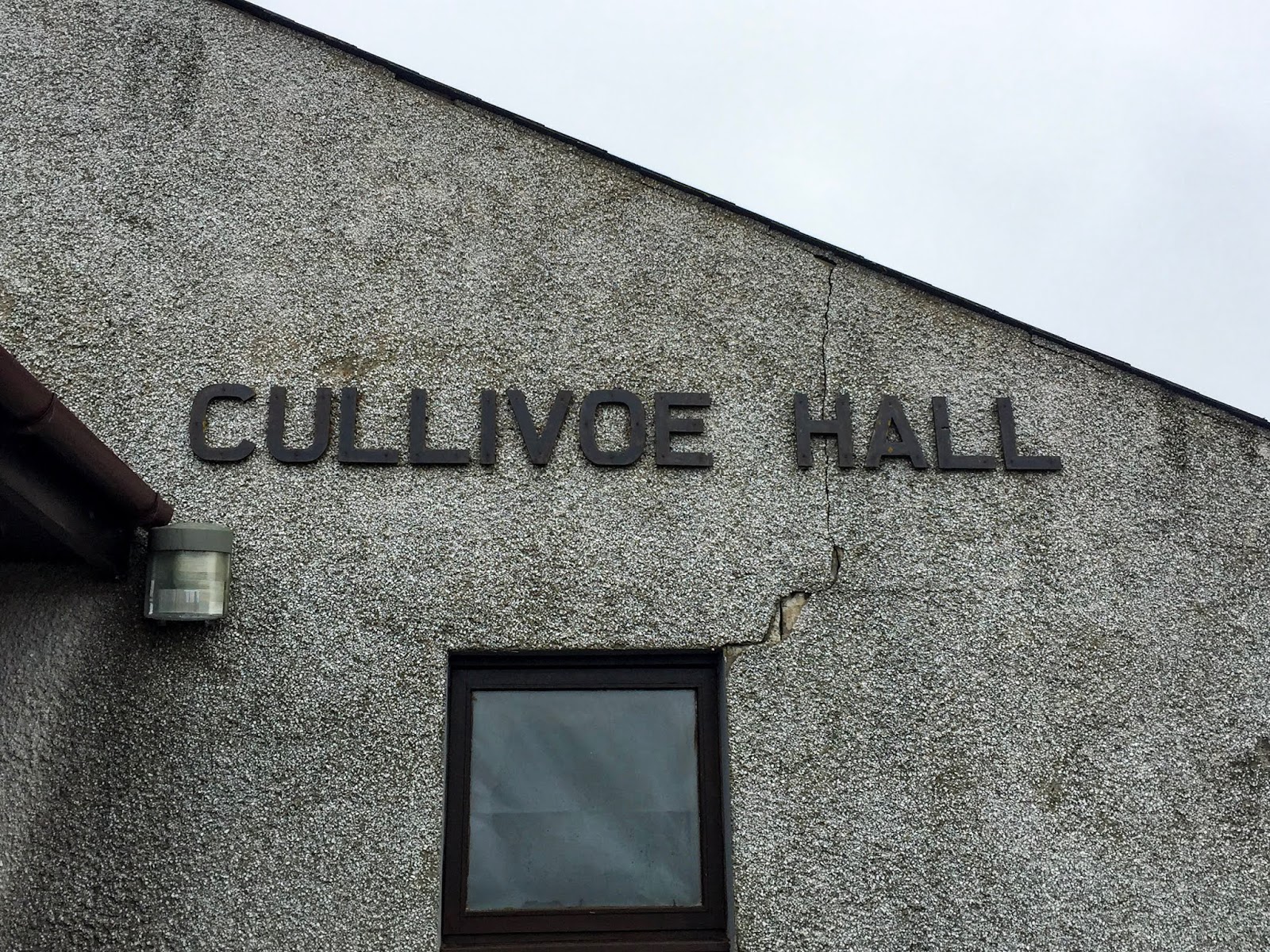
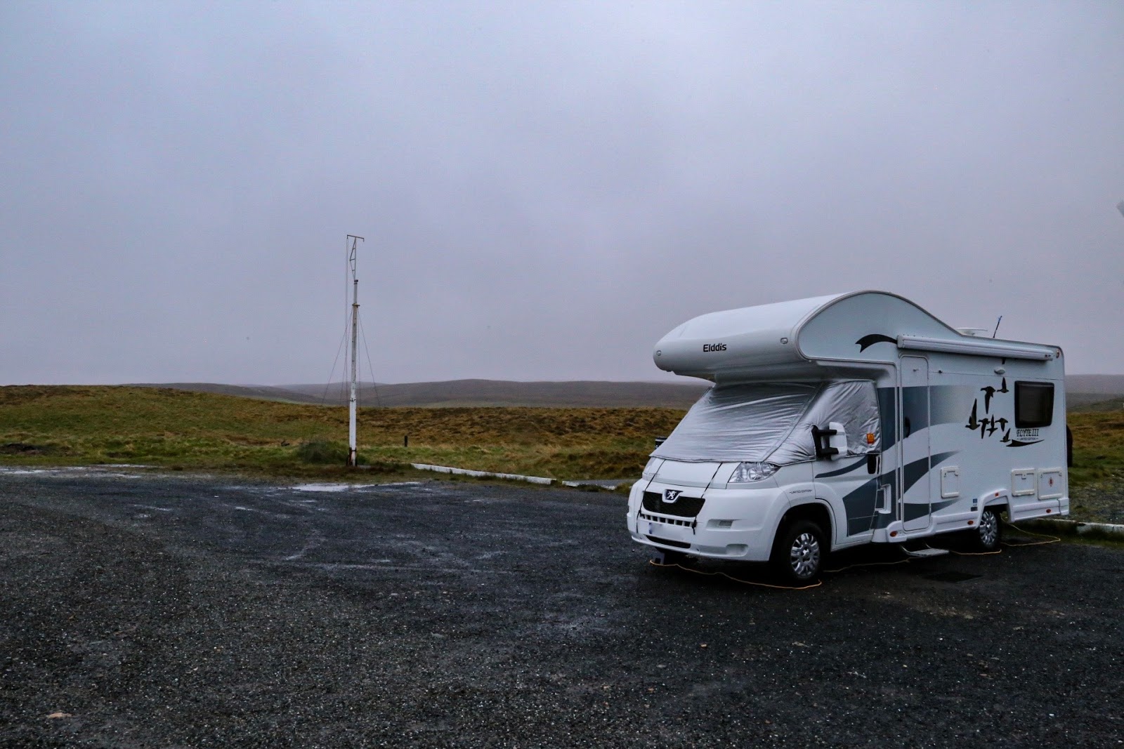

We decided to move further
north on Yell before crossing by ferry to Unst. Cullivoe Community Hall has a
large car park, which also includes electric hook ups and water. The toilets in
the hall were left open for us. Although we seem to be of the beaten track,
even for Yell, there were facilities available.

Opposite the hall is a well
stocked shop and post office.
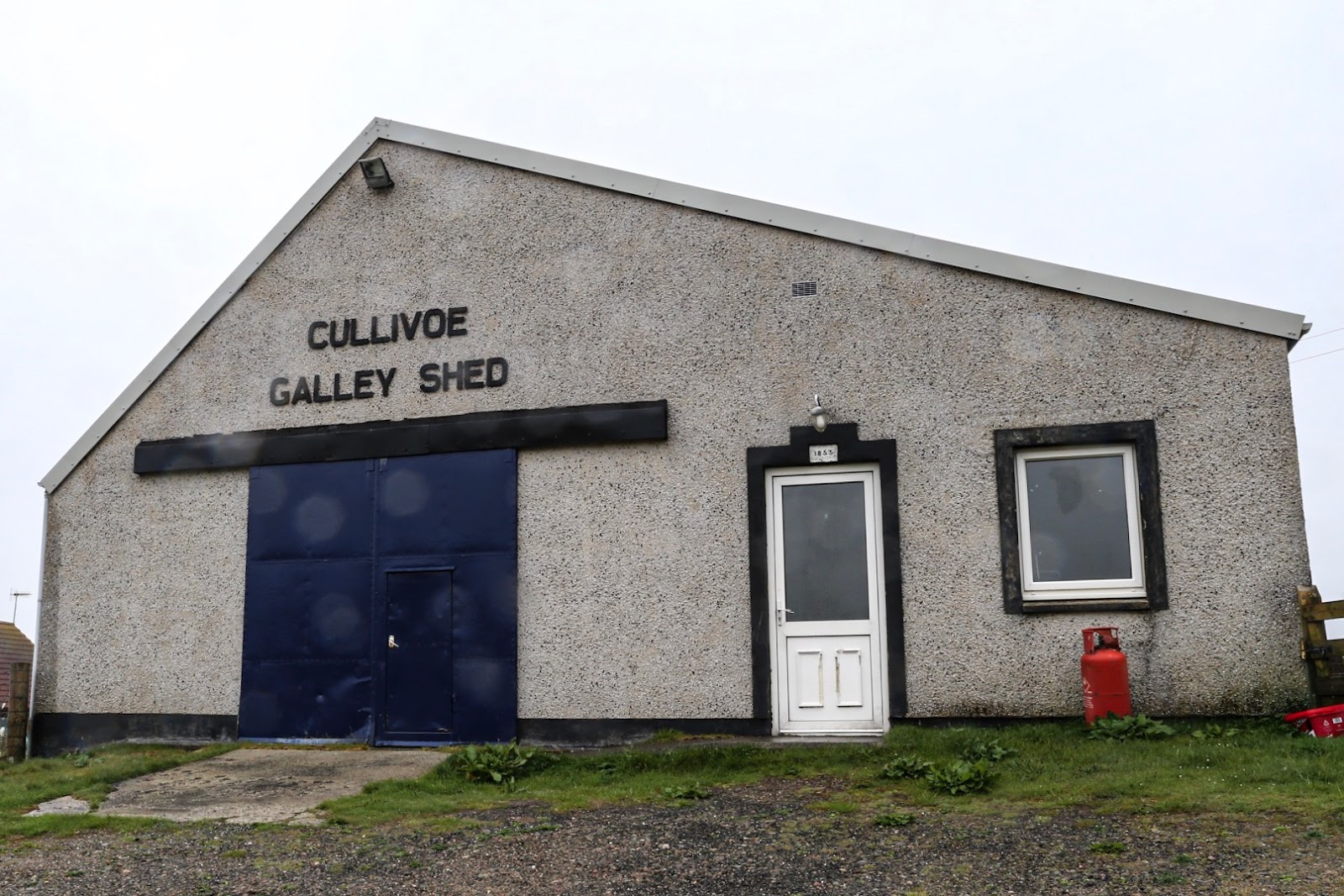


Bad weather followed us
from Burravoe, rain and the Shetland mist put pay to any walking but just down
from the shop is the Cullivoe Galley Shed which is not only staging an Up Helly
Aa exhibition but it is actually the building where all the preparations take
place and the equipment for each years Viking fire festival is stored. Cullivoe
is one of the many fire festivals held on the Shetland Islands but the only one
on Yell. This local event is held every year on the last Friday in February.

This Community Hall is the
centre of social life for the immediate area and we were invited to watch da Shanty Yellmen having a practice session
to prepare for their performance at the upcoming Sligo Festival in Ireland. Da
Shanty Yell men is a group of men residing on the Islands of Yell and Unst,
formed originally to support Sail Yell celebrations in 2011, when the “Tall
Ships Races” visited the area. They recorded and released an album in 2013
called Silver Darlings, which we
later purchased, and are recording a new selection of music under the working
title of ‘Cullivoe Hall Rehearsals’ that is due for release in 2020. And what an enjoyable
evening it turned out to be. The songs they performed were mainly linked to the
sea and some were sung in the local dialect, they took time out to explain the
origins and meanings of the songs as well as some local history.


The following morning we
again woke to the famous Shetland weather - rain and haar. Thankfully it
cleared by mid-day and after lunch we cycled to Breckon Beach in some lovely
warm sunshine. Sheltered from the south westerly wind, Breckon lies at the
northernmost tip of Yell and has some rich fertile land that has been
cultivated over many years and offers proof that both the Romans and the Viking
have settled. In fact the outline of a Viking longhouse can still be seen.


Along the shore side of the
Wick of Breckon lays a glorious shell-sand beach that is part of a dune system
that’s ever changing due to tide and strong winds. From the far side of the
beach you can walk out on the grassy headland that forms the Ness of Houlland.
From here can be seen some more of the rugged coastline that I found so
fascinating.


A walk across some farmland
takes you up to a ruined Croft house and the local cemetery. Back to collect
the bikes and a well earned rest and a chat with a very friendly farm dog
before returning back to Cullivoe.

Gloup was the second largest
fishing station in Shetland. In July 1881 58 men lost their lives in fishing
disaster which devastated the local community and had repercussions throughout
the islands. The Shetland sixareens were used for haaf fishing, these were open
boats generally some 30 feet long and were propelled by upto eight oars and
rowed 40 miles out to sea. In total ten boats were lost when a storm arose and
the men could not get back to shelter. Lives lost in the exploitation of men’s
hard labour in the service of the boat owners. Pay for up to fourteen weeks
hard and dangerous work could be less than two pound.


Erected in 1981 is a
memorial with a carved statue of a woman and child, similar to the one that can
be found at the harbour at Kirkcudbright, the woman is shown shading her eyes
as she peers in the direction of the open sea. Like Kirkcudbright it represents
the many widows and fatherless children left after fatal tragedies at sea.
Below the statue are listed the names of boats and the crew that perished at
sea and where they stayed. A very poignant spot surrounded by some beautiful
countryside.


After some rather sad and
reflective moments at the memorial a long walk was in order. From this spot you
can walk across country up to a trig point at 373 feet and admire the wonderful
views. After reaching the trig we
descended towards the dramatic Gloup Voe and along a wee path that you
certainly would not attempt in bad weather. Still we got back safe and sound,
collecting our bikes and back to Cullivoe Hall to prepare for the next section
of our trip.
Unst - Uyeasound.

Unst is the most northerly
inhabited island in the British Isles, 12 miles long by 5 miles wide,
and is reached by ferry
from Gutcher on Yell across the Bluemull Sound to Belmont. A short drive from
the ferry is Uyeasound a picturesque and busy wee centre for fish farming.


Gardiesfauld Hostel Caravan and Camp Site overlooks the sea and offers 5 touring pitches with EHU and water. Although it’s called a ‘Youth Hostel’ most of the people staying there were not that young. Inside the Hostel are the showers, toilets; kitchen and laundry facilities open to all campers.


Gardiesfauld Hostel Caravan and Camp Site overlooks the sea and offers 5 touring pitches with EHU and water. Although it’s called a ‘Youth Hostel’ most of the people staying there were not that young. Inside the Hostel are the showers, toilets; kitchen and laundry facilities open to all campers.


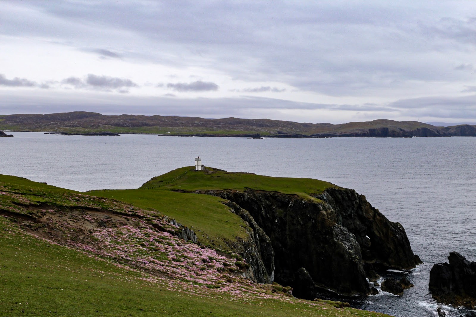
Just a short walk along the
shore can be found the inshore Uyea Sound Lighthouse A3830, a small navigation
light which is the property of the Northern Lighthouse Board provide “for the
safety of all mariners”


A short bike ride from
hostel is Muness Castle “erected out of the sweat and tears of Shetlanders”.
Lawrence Bruce the builder of the castle was a petty tyrant, yet a man of
exquisite taste. Half brother to Robert Stewart, Earl of Orkney (Orkney)
he was made sheriff-depute and chamberlain for the lordship and bishopric of
Shetland in 1573.


The castle sits near the
shore of Uyea Sound, once an anchorage for ships trading between Shetland and
Leith. Unst was also in close touch with the German trading port of Bremen, a
town we visited on last years Scandinavian trip (Scandinavian
Trip). So it’s likely that much of the castles furniture was brought from
all over the continent.


Baltasound is the islands
chief settlement with a couple of general stores allowing us to restock certain
food items.


On the cycle ride back we turned off for Westing to see the remains of Viking settlements and a longhouse.


On the cycle ride back we turned off for Westing to see the remains of Viking settlements and a longhouse.


A short ride away is the secluded Lund beach
with its Kirkyard and the decaying 12th century Kirk of St Olaf.


Situated in Haroldswick is
the Unst Boat Haven, Shetlands only museum dedicated to the history of the
islands distinctive wooden boats and the line-fisherman who used them until the
early 20th century.

Also on display is the Far
Haaf a locally built replica of a sixareen.

But before our visit to the
museum we visited one of the rare tearooms on these northern isles. Victoria’s
Vintage Tea Rooms and Gift Shop. Established at its current location in 2015
following a trial run in the local hall it boast some very delicious home
baking, a vast selection of teas and some good Italian coffee.


Just before you enter the settlement of Haroldswick, named after King Harold of Norway who landed here in 875 to annexe the Shetland Islands, can be found a replica Norse longhouse and the Skidbladner a full sized replica of the Gokstad ship that can be found in Norway.


Hermaness National Reserve
is famed for its seabird colonies and from its furthest point can be seen
Muckle Flugga topped by the most northerly lighthouse in Britain. The current
lighthouse was designed and built by Thomas and David Stevenson in 1858.
Thomas’s son Robert Louis Stevenson is said to have based his map of ‘Treasure
Island’ on Unst following his visit as a young man in 1869. Automated in 1995
the lighthouse was one of the few that had a separate shore station for off
duty keepers. This was sold off at the same time the lighthouse was automated
and is now a visitor’s centre, although it was closed when we visited the area.


The walk through the nature
reserve from the car park above the visitors centre is very rewarding with
sightings of Great Skua’s and cliffs covered in a blanket of Gannets.
Dangerously windy at the cliff edge but thankfully it was blowing inland! Lots of nesting Great Skua’s to fascinate on
the way back down to the car park.
Northeast Mainland - Delting.

The following morning it
was time to leave the Northern Isles and travel back to the Shetland Mainland
via two ferries, Belmont to Gutcher and then Ulster to Toft. But before heading
for our next campsite we needed to travel to Lerwick to pick up supplies from
the only Tesco anywhere on the Islands. Certain food can be obtained from local
general stores but even these are not everywhere and can be some distance from
our base, but one has to adapt to the different circumstances that you find on
your travels.

On the shore of the Busta
Voe is the village of Brae and because it’s close proximity to Sullom Voe Oil
Terminal offers many convenient facilities including a large leisure centre
with a very nice 16 metre swimming pool which of course we took advantage of.
Also there is a well-stocked Co-Op where you can actually get a copy of The National. In Brae we had pavements
and street lights something we had only seen in Lerwick.

Brae is also famous for
Frankie's Fish and Chips, the most northerly chippy in Scotland, a little
expensive, but worthy of its high standing.


The Delting Boating Club is
a short way north of the village and offers 13 touring pitches. On signing up
to camp you get to be honorary members of the boat club and can use their
toilet and shower facilities. It turned out to be a very busy site with lots of
folk staying over for just one night.

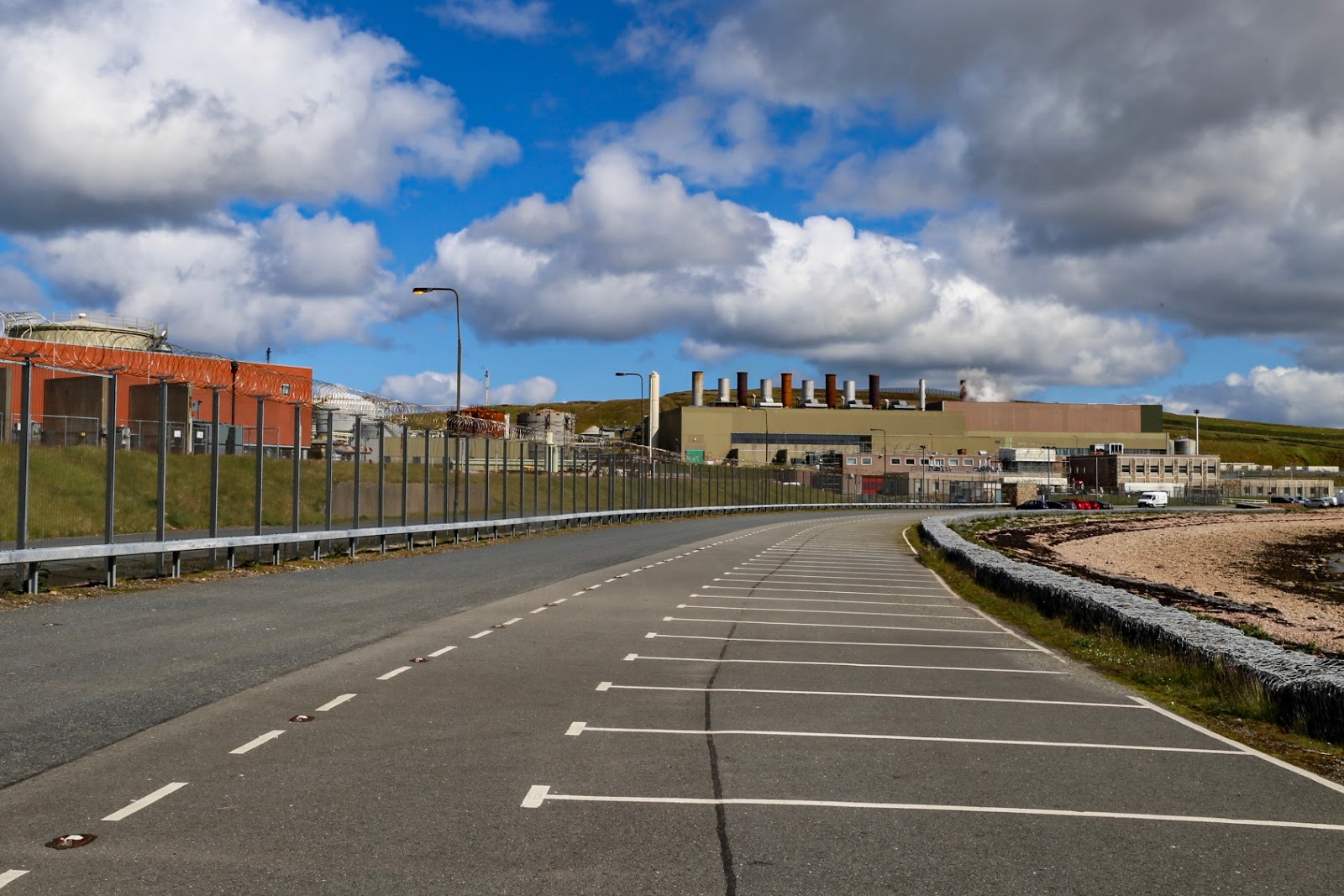

Sullom Voe is the longest
fjord in the Shetlands and was an RAF and Norwegian flying boat base during
World War Two. Europe’s largest oil and liquefied gas terminal has stood on its
eastern shore 7 miles northwest of Brae since 1978 and has the most friendly
security guards you can find anywhere - we got a little to close to the main
entrance!

Also there is Scatsa Airport a little way off the terminal and is used for oil related flights many going to and from oil rigs from Aberdeen.

Also there is Scatsa Airport a little way off the terminal and is used for oil related flights many going to and from oil rigs from Aberdeen.


One of the main reasons for
staying at this site is its close proximity to Muckle Roe that offers a grand
opportunity for an interesting walk across some wild but beautiful countryside
that was the root of a 350 million year
old volcano, it is linked to the Shetland mainland by a road bridge. Persevere
with your walk to the top of the island to see its magnificent cliff scenery
known as the Hams. On the way up to the magnificent low red granite cliffs you
will pass the abandoned remote and isolated settlement of Ham.

It was on the walk back
that we spotted Selkie seals basking on the rocks and swimming in the bay, we
counted between 12 and 13 which was the largest amount of these common seals we
had seen in one place to date.
North Mainland Northmavine - Braewick.

To reach our next campsite
you have to cross the Mavis Grind a narrow isthmus that divides the North Sea
from the Atlantic. Eshaness and the district of Northmavine again offer more
spectacularly striking coastal scenery including a remarkable set of stacks
known as The Drongs that could be seen from Braewick Cafe and Caravan Park, as
soon as the Haar evaporates!


Again this is a busy site but very well organised with 10 fully serviced marked out pitches for tourers. Two different price levels are offered, 24 pound per night for a grand sea view or 18 pound per night for a pitch further back. Showers are included in the cost; if only people would clean up after themselves they would be fine.

The following day was
completely lost due some very heavy rain and strong wind but it gave a chance
to catch up with the Blog and even start a new book. Blind Eye is my fifth Logan McRae novel by one of my favourite
crime writers - Stuart MacBride, so all was not lost.

Shetlands weather is hardly
ever the same two days running and the following day warm sunshine followed
some early wind and rain so the bikes came off and after a short bike ride to
Stenness a lovely walk followed.

Stenness has a sheltered
anchorage and a shingle beach backed by some grassland, which made it an ideal
place for a Haaf fishing station, which had up to 40 boats operating throughout
the summer. The ruins of a fishing bod
can still be seen on the beach. Its ground floor was a combination of storeroom
and shop and the upper level, which had windows and a fireplace, was
accommodation for the Lairds representative who would have overseen the fishing
operation. It was from beaches like this one that men went 40 miles of the
coast in open Sixareens to catch Cod and Ling. The catch was laid out on the
beach following preparation and salting before being transported in barrels.


From here you can walk up
to the Esha Ness Lighthouse passing yet another trig point and enjoying the 360-year-old
volcanic coastal rock formations.


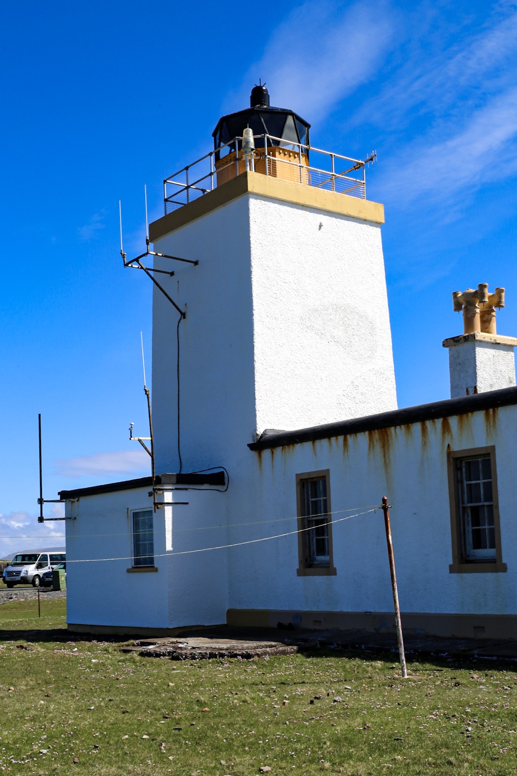
This Lighthouse is just one
of over 200 that are located around the Scottish coastline operated and
maintained by the Northern Lighthouse Board. Designed by David A Stevenson in
1929, this 12 metre high lighthouse (61 metres above sea level) was the last
manned one to be designed by a Stevenson engineer and has a nominal range of 25
nautical miles.


Take some extra time to
walk further north to see the ruined Broch of Houlland, which stands on small
island in a loch and dates from the third century to the first century BC.


There always seems to be a
fascinating Kirkyard to visit and this walk was no exception. The site of the
medieval Cross Kirk is dedicated to the Holy Rood and was one of the principal
chapels of pilgrimage in Shetland. Buried in the cemetery is John Williamson of
Hamnavoe better known as Johnnie Notions for his inventive mind and is one of
Northmavines great characters. An uneducated man who designed his own
inoculation against smallpox saving over 3000 local people from this 18th
century scourge of Shetland - he never lost a single patient.

The locally famous Donald Robertson
died in 1848 at the age of 63. His inscription reads as follows “ His death was much regretted which was
caused by the stupidity of Laurence Tulloch in Clothister (Sullom) who sold him
mitre instead of Epsom salts by which he was killed in the space of 5 hours
after taking a dose of it”


Not far from the campsite
is the Tangwick Haa Museum, which illustrates different aspects of Northmavine
life through out the years by using a mixture of artefacts and photographs.
Also Parish and Census Records can be found and viewed there.


The Haa of Tangwick was
built in the late 17th century for the Cheyne family who owned land in
different parts of Shetland including Tangwick. The building fell into
disrepair in the early part of the 20th century. Part of it was restored by the
Shetland Amenity Trust and was officially opened as a museum in 1988. The
remaining restoration work was completed in 1999. On the day we went a lovely
local lady with a wonderful sense of humour was working there that made our
visit even more enjoyable.


Walking down from the
museum on our way to photograph Dore Holm we spotted a total of 29 seals
basking on the rocks. Their number included some young seals that are light in
colour, our best sighting to date.


Dore Holm is a piece of
rock formation situated off shore and has a magnificent natural arch big enough
for a boat to pass through and is said to resemble a drinking horse.

Hillswick is a sheltered
fishing village on a bay of the Ura Firth that opens out on the magnificent St Magnus
Bay and was a herring station between 1880 and 1914. Herring were brought here
to the beach where they were gutted, salted and packed into barrels before
being sealed for export. By 1914 no herring stations were left in this area.


It is also the start of a
grand 5-mile walk around the Ness of Hillswick. It may start and end gently but
towards the headland the glorious cliffs are high, sheer and have many
dangerous, but exciting edges hidden until the last minute.


The first half of the walk leads to the Hillswick Lighthouse A3840, again more like a beacon and similar to the lighthouse at Uyeasound.


The first half of the walk leads to the Hillswick Lighthouse A3840, again more like a beacon and similar to the lighthouse at Uyeasound.


After stopping for our
picnic in the shelter of the lighthouse the walk continues around the coast
line where you can see the Gordi Stack and get a fine view of the remarkable
Drongs the weird shaped pink granite stacks that were seen from Braewick Camp
Site. At 269 feet the next section was the highest part of the walk. Towards
the end of the walk is the bay of Sand Wick and the descent back to the village
that has a well stocked general store and post office.


Below the community store are the renovated Cutch Kettles. These were used to preserve fishing lines, nets and sails from around 1840. It was still in use on a small scale in the 1960’s. Cutch is a bark product, very rich in tannin, obtained mainly from the acacia catechumen tree found in India and Myanmar. The cast iron vessels used for clutching were called kettles. They were filled with water and cutch. Cotton lines or nets were soaked and then spread out to dry. This was repeated as necessary. The cutch turned the sails brown.
By the following morning
heavy rain set in again so this meant that we have a restful day and time to
catch up downloading photos and writing blog before moving on again.
Northeast Mainland - South Nesting.


Our last stop was at the
South Nesting Public Hall and Campsite situated on the east facing peninsula 17
miles north of Lerwick, another beautiful and tranquil area. The site was
opened in 2014 and offers 8 touring pitches each one with electric hook ups and
water. A shower room with a toilet is provided in the adjacent hall and a rota
of very friendly local ladies keep these facilities very clean.


This is a grand area for walking and cycling and a short walk was in order after we set up. Heading east across the hills and down to the shore offered a fine view of Hoe Stack and its Lighthouse. Sitting on the shore in what was warm sunshine listening to the sound of the sea and the every present bird’s must rate as one of life’s real pleasures.


Our next trip out included
the lighthouse at the Mull of Eswick that has some wonderful panoramic views of
various islands including Fetlar and Whalsay and a closer view of the
lighthouse on Hoe Stack. On a clear day you can see Lerwick from here.


Also worth your time is the walk around Lingness. Here we came across a lived in settlement that had been renovated to a very high standard. We were lucky enough to meet Robert, the son of the man that owned the property, along with his collie dog Bolt. Like all the Shetlanders we have met he took time out to talk to us and explain a little of the history of the cottage and its outbuilding’s including how it was nearly washed into the sea by a bad storm, but the only real loss was the huge stock pile of peat that was taken by the strength of the sea. Roberts’s family have lived in this area for over 500 hundred years.

A grand circular walk
followed with fine views across Es Wick Bay and the surrounding countryside.

Shetland Museum and
Archives was worth a day of our holiday although we had to travel into Lerwick
by Motorhome because of the awkwardness of the public transport link from our
present Campsite. Parking was ok with quite large parking bays in some streets.

The Museum, which is built
on the historic early 19th century Hays Dock, has a large reception area
combined with a gift shop and a Cafe Restaurant on the upper level. Exhibition
galleries are spread over two floors. The Lower Gallery concentrates on the
period up to 1800, while the Upper Gallery covers from 1800 to the present day.
Each gallery tells the “Shetland Story” through twelve themed areas. A word of
warning, allow yourself plenty of time to digest the history on offer, as it is
very interesting and informative.


From South Nesting to
Lerwick is only a 35-minute drive so we had plenty of time before we had to be
at the Ferry Terminal. Even with some last minute shopping and a delicious sit-in
Fish supper for lunch we still had time to visit the Lerwick Galley Shed to see
the Up-Helly-A exhibition.


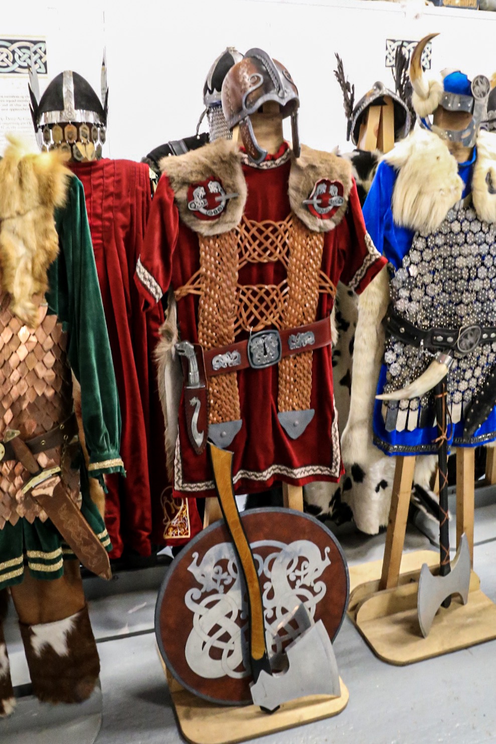


We were met by the former Jarl;
Peter Malcolmson, whose 1984 squad name was Eirik Bloodaxe Haroldson. What an
interesting gentleman he turned out to be, showing us a wee film about last
years Fire Festival before showing us around and explaining all about the
preparation’s, its administration and what leads up to the festival day itself.
It all sounds grand fun and very social. It was in fact a grand way to finish
our 5-week stay on these islands.
Shetland Ponies.


Small ponies have been in Shetland for 2000 years and are believed to have been in domestic use all that time. A natural selection process meant it was the smallest ponies that survived Shetlands harsh winters when there was very little food to eat. Ponies were used on crofts for pulling ploughs, carrying peat downhill and also as a means of transport. When in the 1800s the Mines Act prohibited women and children working underground the Shetland pony was a suitable substitute being small and strong.
Seals.

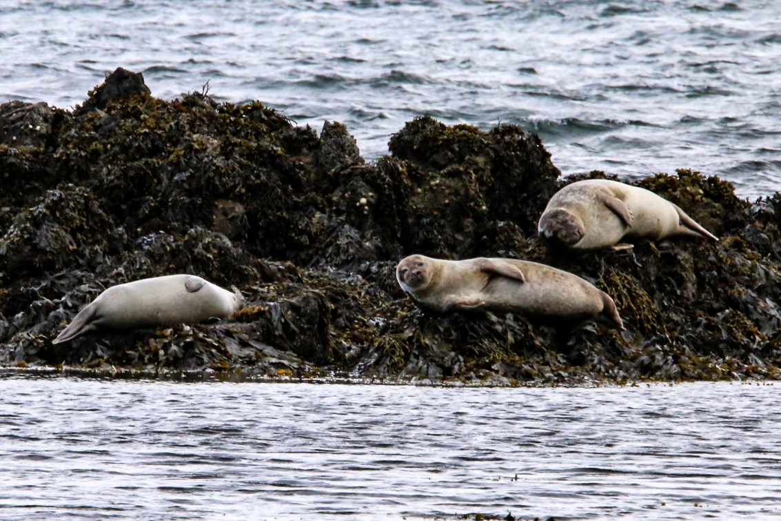


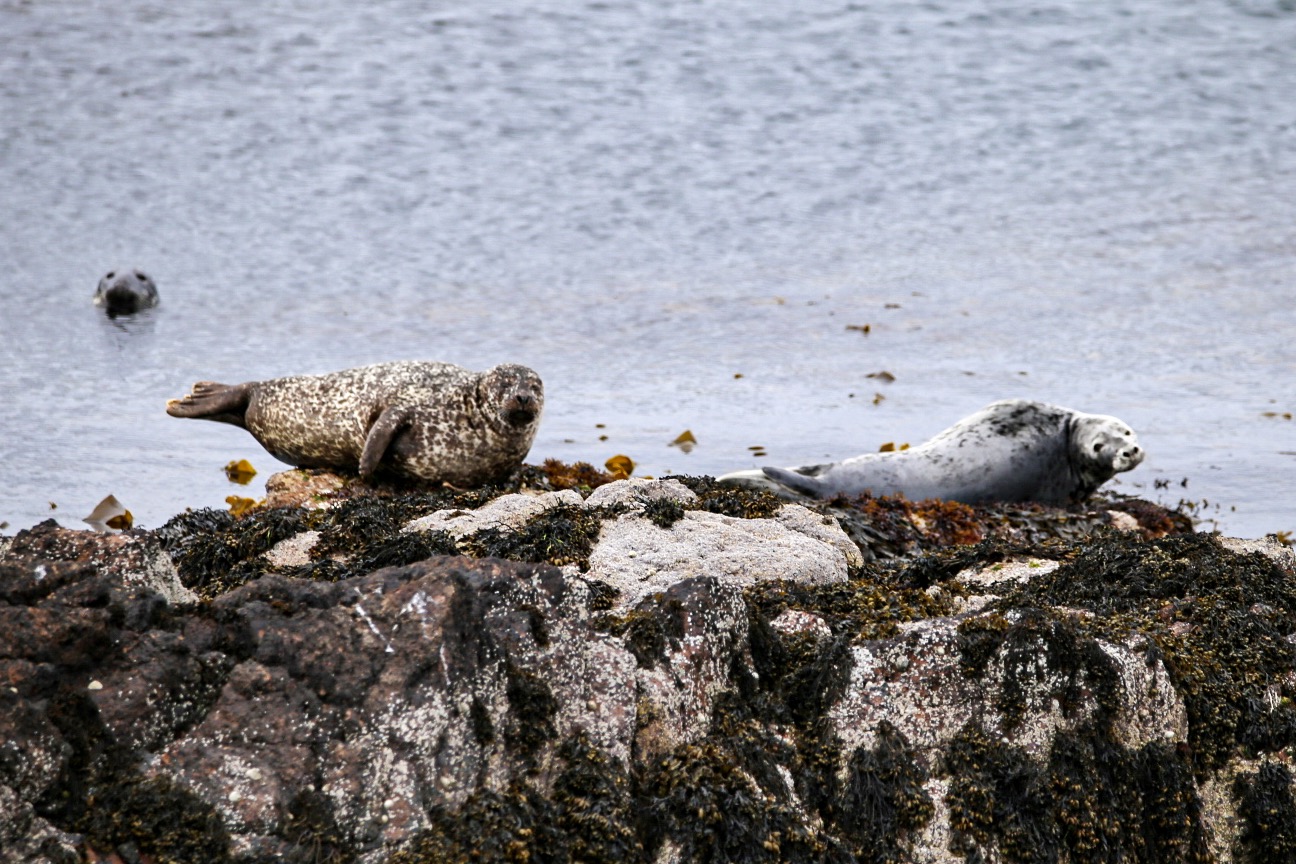


A common sight around the
coast is the grey and common seal. You will find them basking on the rocks, or
inquisitively watching you from the water as you watch them. Greys are the
biggest with a larger angular head while the common seal has a much cuter face.
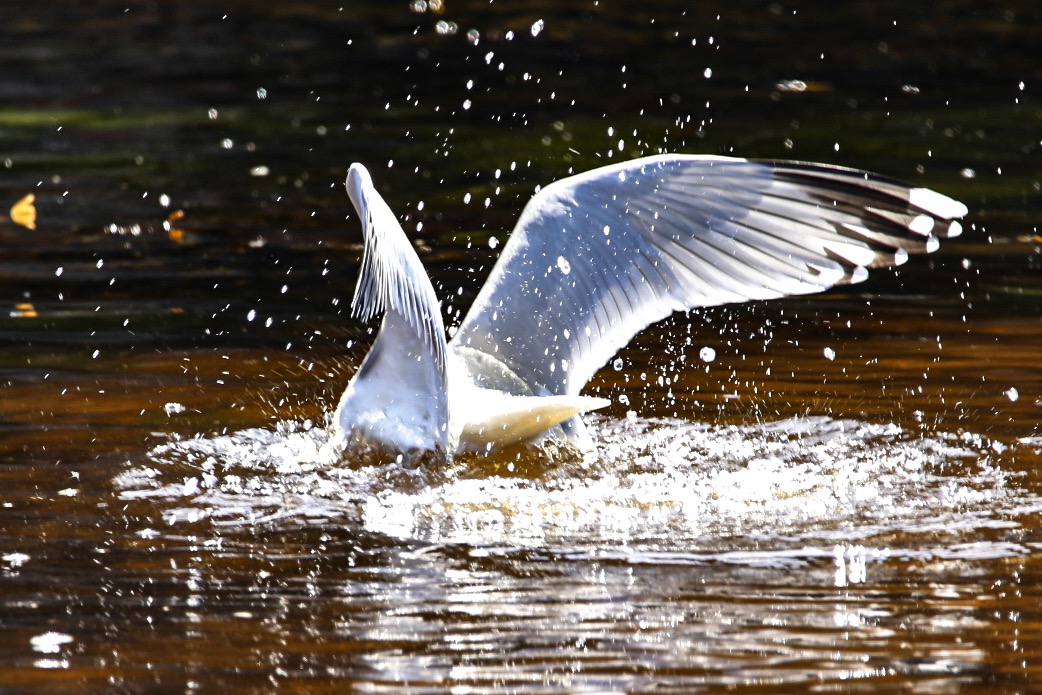
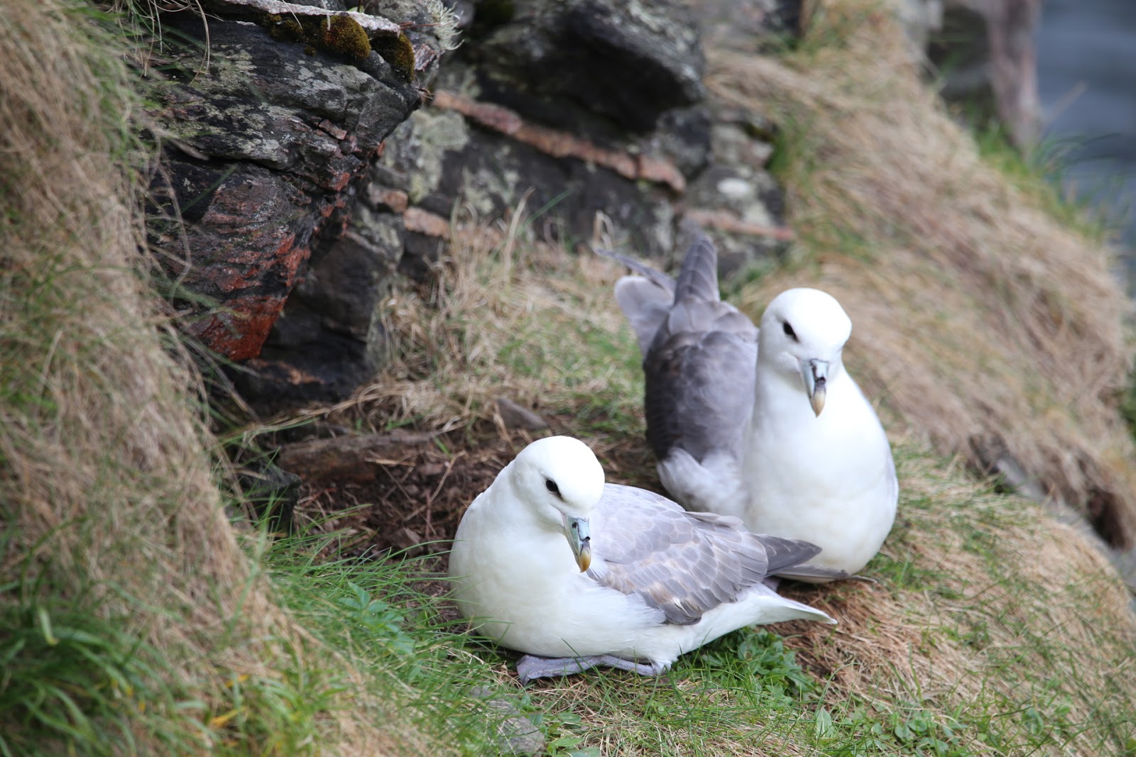
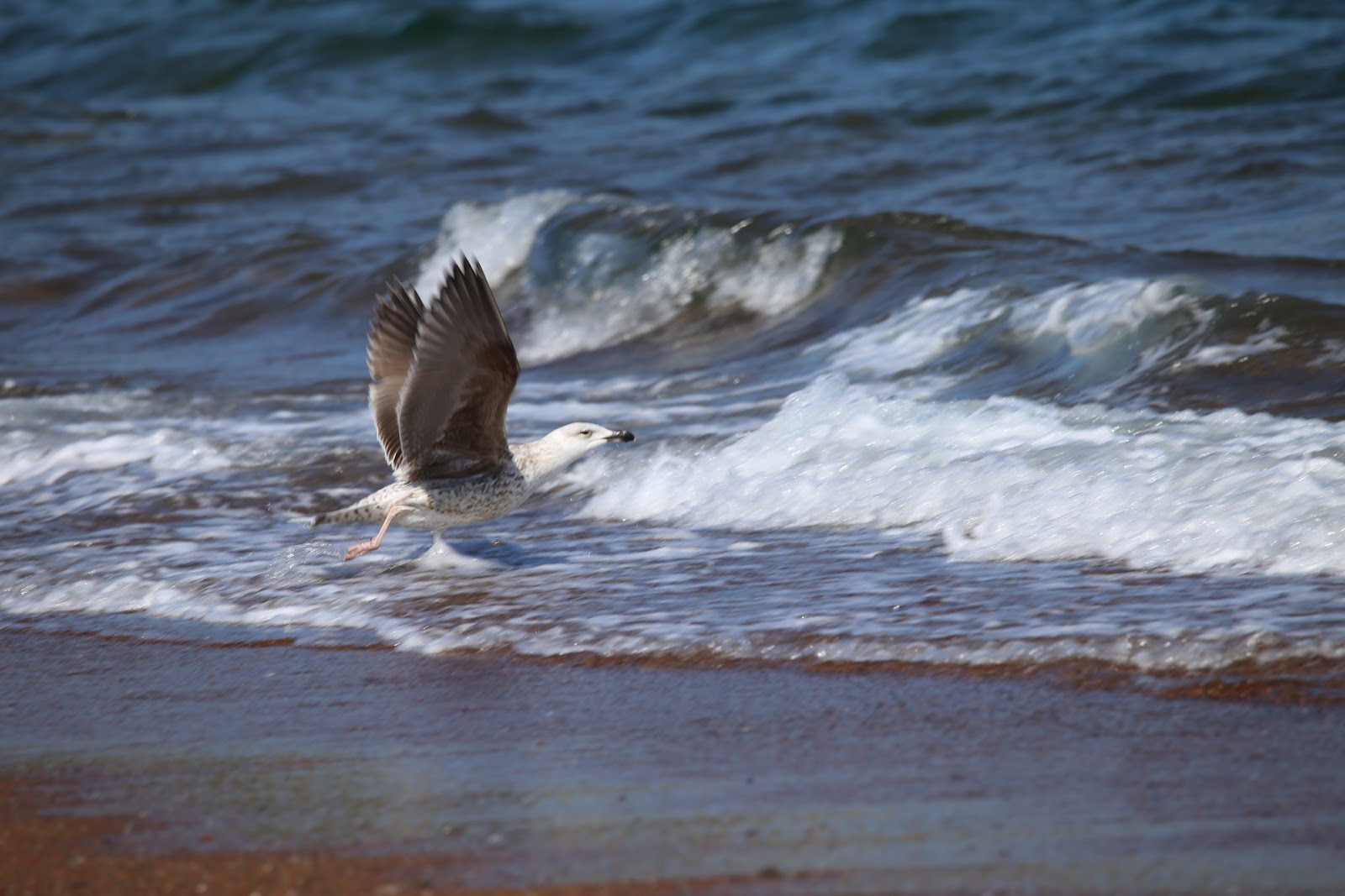
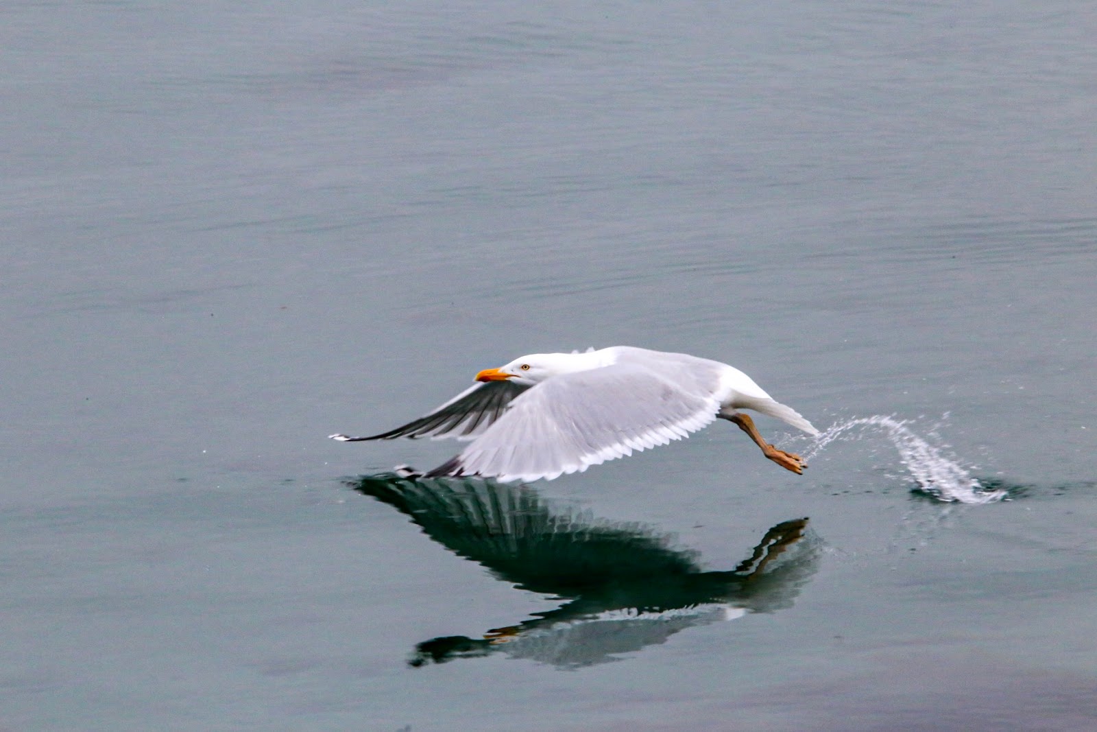
Birds.


 |
Puffin or Tammy Nories. |


 |
Herring Gull. |


 |
Mute Swan. |


 |
Fulmar. |


 |
Great Skua. |

 |
Turnstones and Arctic Skua. |

 |
Eider Duck. |
 |
Red-breasted Merganser. |

 |
Oystercatcher. |


 |
Fulmer. |
 |
Razorbill. |


 |
Yellow Legged Gull. |


 |
Guillemot. |

 |
Greylag Goose. |
 |
Starling. |
 |
White Wagtail. |


If there’s a common sound right across Shetland it’s the birds. From early light until it finally gets dark it accompanies you ever where you go. The islands rich fishing grounds and its spectacular cliffs make it a perfect location for seabirds to breed and raise their chicks. Also the diversity of the inland terrain supports some of the rarest breeding moorland species in Scotland.


And of course the sheep –
all 281644 of them!
Comments and Observations.
During our five-week stay
on Shetland it was reported in The Shetland Times that the Isles were named
sixth in Lonely Planets list of Best in Europe destinations for 2019. Shetland
is the only UK destination which made this years list. Let’s hope that by
attracting lots more tourists to this unique part of Scotland does not lead to
infrastructure and overcrowding problems that have beset the NC500 and Skye.
One of the most enjoyable parts of this trip was the fact that the roads are
very quiet and everywhere you go does not have reams of tourist spoiling the tranquillity.

Shetland has longer
daylight hours than any other part of the UK. On their longest day, the 21st
June, the sun rises at 3:38am and does not set until 10:34 giving daylight for
nearly 19 hours. This is because Shetland is only 400 miles from the Artic
Circle.

The weather can be very
changeable. On our first day on the islands we had sunshine, rain, sleet and
finally snow. So best come prepared for all eventualities, although it can be
cold at times you do get used to the different weather conditions and when the
sun comes out you could not want for a more beautiful place on earth to visit
and explore. We lost a few half days and only two full day to heavy rain and
strong wind. Normal daytime temperatures are between 8 and 11 degrees although
it can feel a lot colder. At night and early morning the temperature does drop,
but as I have said dress properly and it’s nae a problem.
One of the most pleasing
things about Shetland is the people that live there. They are the most
friendliest I have ever come across, nothing is too much trouble and they are
always interested in you, where you came from, what you think of the islands.
Finding out we were on Shetland for five weeks seem to please them even more
asking us if we are coming back – I think the answer to that question is
certainly yes.

Although one of the
remotest parts of Scotland, its scenery is absolutely stunning. The rocky
coastline is dramatic; a lot of its beaches are havens of sand and perfectly
clear sea. It is said that you're never more than three miles from the sea.
Inland you have vast areas of moorland and peatbog although some areas have
been cultivated. The roads are great for cycling and there is no restriction on
where you walk, but you are asked to keep your dog on a lead because the sheep
were still lambing.


Excellent blogging you must return to visit the rest of the islands one day
ReplyDeleteMany thanks for the blog from Shetland as "promote Shetland" published on Facebook today. I've been to Shetland twice. I also read "Scandinavian roadtrip 2018" and I am so sorry that you had such negative experiences with Norwegians. And yes; The roads here are not always the best, unfortunately. Good luck with upcoming trips
ReplyDelete